|
|---|
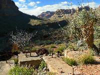
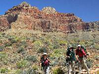
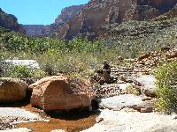
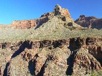
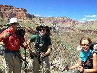
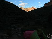
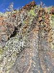
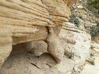
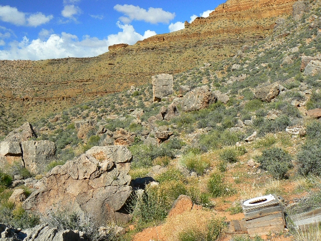
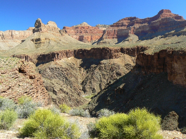
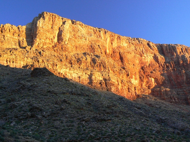
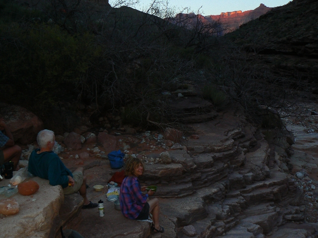
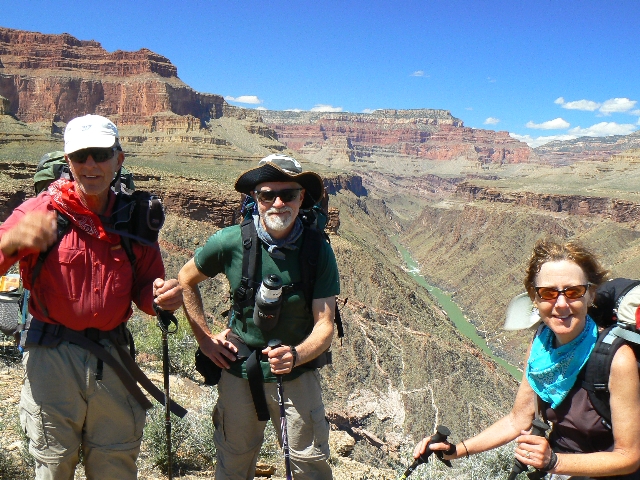
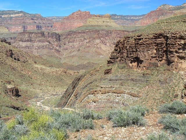
Old Hermit Camp
(Click the image for a full-size view)
|
|---|

|
|---|
Old Hermit Camp
(Click the image for a full-size view)
|
|---|
|

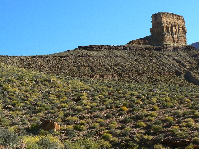
|
|---|
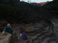
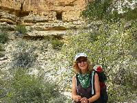
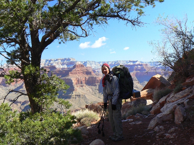
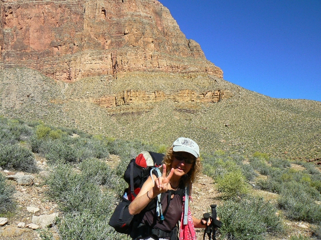
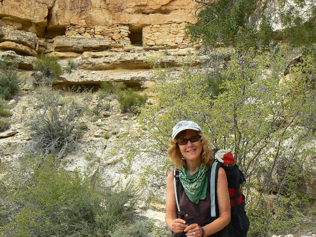
Kathleen indicates Day 2
(Click the image for a full-size view)
|
|---|
|
|
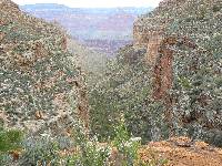
|---|
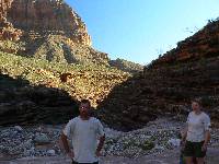
to Boucher
(Click the image for a full-size view)
|
|---|
|
|
|---|
to Boucher
(Click the image for a full-size view)
|
|---|
|

|
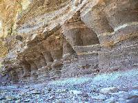
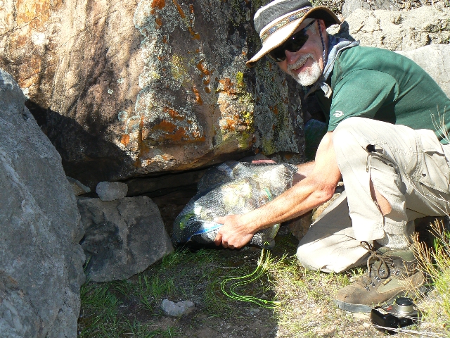
|---|
Boucher cache
(Click the image for a full-size view)
|
|---|
|
(There are - More photos below the trip narrative.)
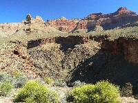
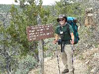
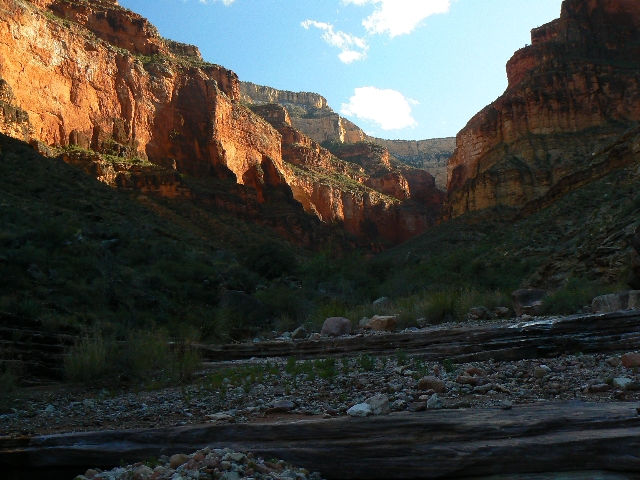
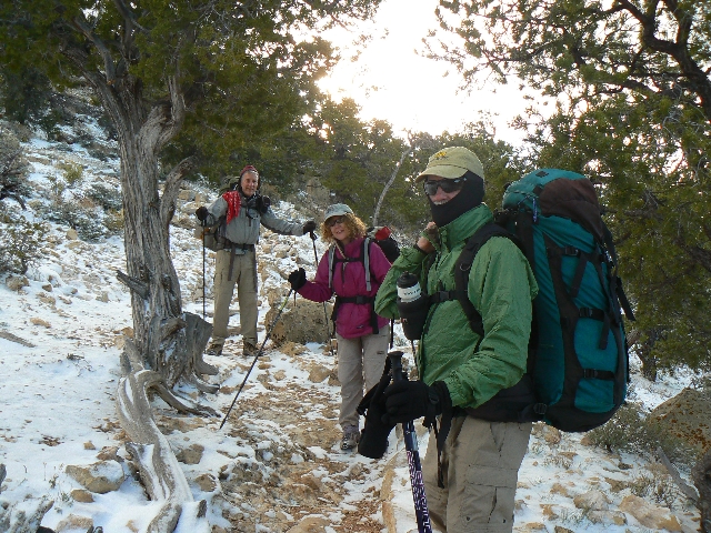
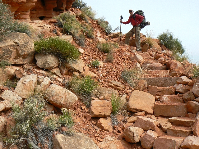
Day 1: Hermit Slide: Hermit's Rest TH to
Hermit Creek Camp; 8 miles, ERM of 18 (approx. 670' ascent and 4400' descent
over 8.1 miles).
Slipping off the rock and hitting the trail with a splat,
I discovered another black ice trail rock in the top section of the Hermit Trail. Ouch.
Five layers of clothes and wool mittens and hat are just about right in this mid 20F stroll
laden with enough food for 9 days and 8 nights. A Gem of an adventure!
A number of switchbacks down and the ground is a
bit thawed and the ice less frequent. A raging, albeit brief, storm had zipped through
last night, coating the rocks and trees with a dappling of snow and ice. Lucky us.
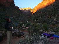
Now, I'm sitting on our same kitchen rock from last
year's
Hermit Hiatus 2008. (click here for the full report)
, gazing at streamside Monkey Flowers and listening to the
burble of Hermit Creek - thankfully drowning out much of the miserable air tour terrorist
noise. See the "closing comments" at the end of this page for notes about returning natural
quiet to The Grand Canyon.
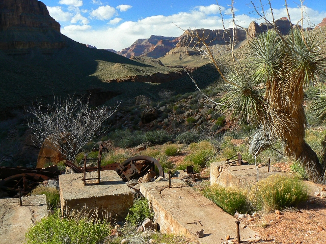
Natural quiet? Not often - even here. Kathleen,
Chris, and Zig are napping and I'm off to explore what's left of Hermit Camp, the camp
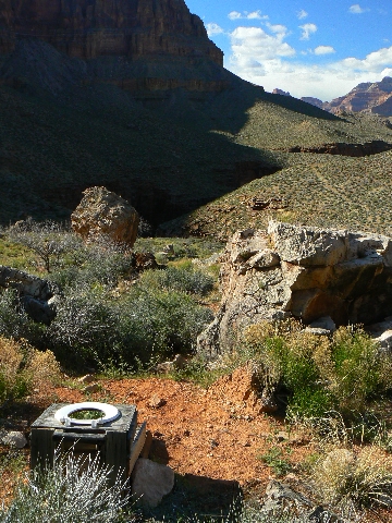
developed in years of yore by Boucher the Hermit, that is. I find a splendid scenic toilet
in the historic Hermit Camp.
Link to scenic toilet page. (click here for full scatological display)
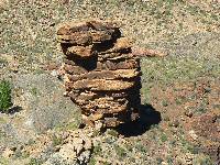
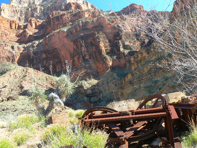
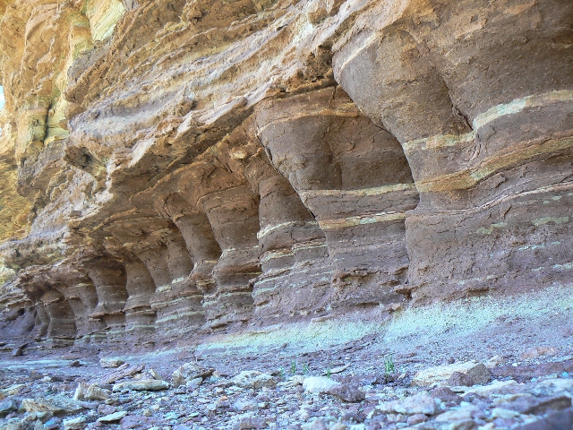
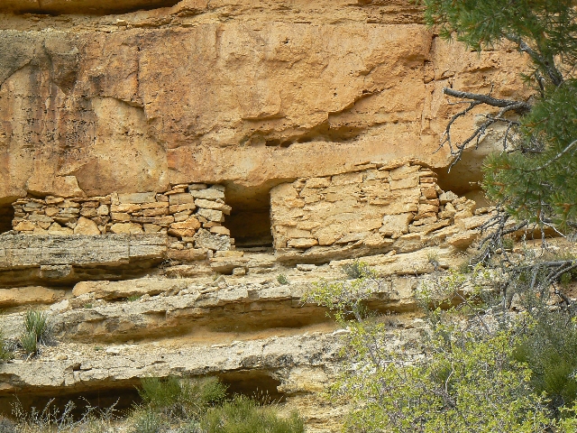
At the old Hermit Camp, I find several large iron
cable wheels, a root cellar, a cistern, and many leveled tent spots.
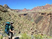
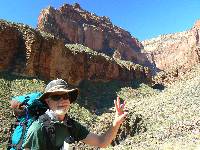
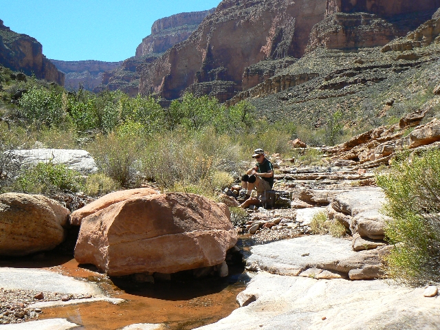
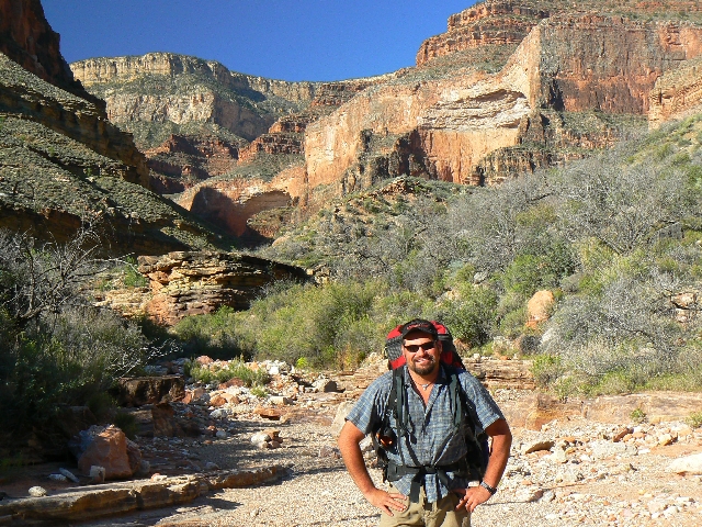
Day 2: Boucher Bop - Hermit Cr. Camp to
Boucher Cr. 5.8 miles; 9 ERM.
GPS total: 13.9 (5.8 today);descent of 5411' (1012 today); ascent of 1467' (796 today).
I sleep well and soon it is morning and we pack
slowly and set out for Boucher. As noted in the day's statistics, we roll along the Tonto,
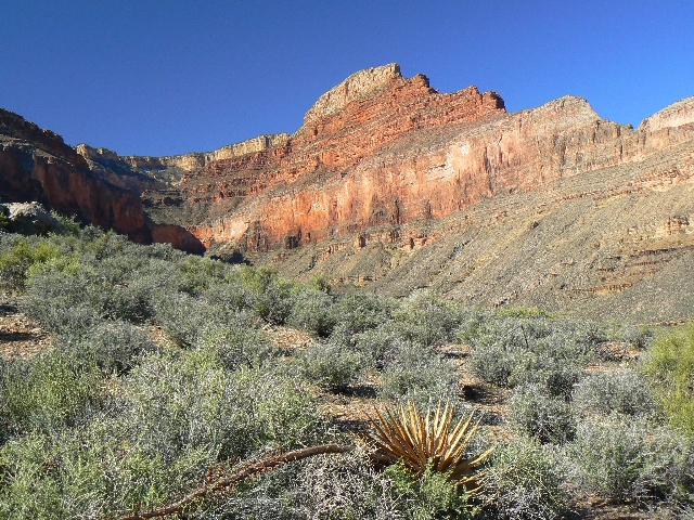
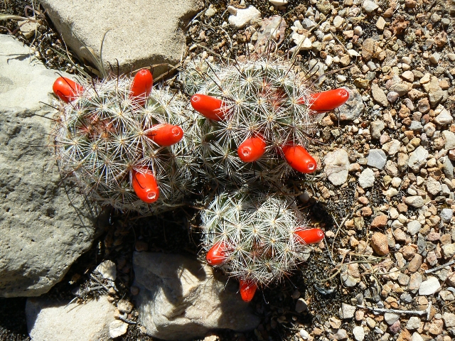
staying somewhat on the contour. Views of The River erupt, punctuated by beginning blooms
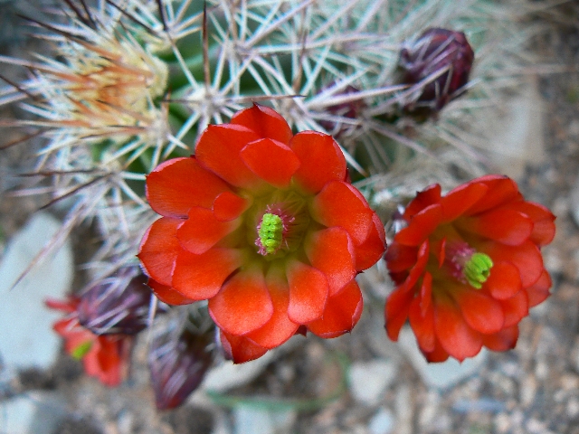
of Lavender, Brittlebush, cactus, Maricopa, paintbrush, and others.
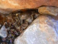
The froggies of Boucher crank up the volume as Zig
constructs the storage granary for our food cache.
|
|---|
Day 3 - going to Slate
(Click the image for a full-size view)
|
|---|
|
|---|
to Slate
(Click the image for a full-size view)
|
|---|
|
|
|---|
Monument in Slate
(Click the image for a full-size view)
|
|---|
|
|
|---|
Chris and Slate Glow
(Click the image for a full-size view)
|
|---|
|

|
|---|
Slate Glow
(Click the image for a full-size view)
|
|---|
|
|
|---|
Slate Glow
(Click the image for a full-size view)
|
|---|
|
(There are - More photos below the trip narrative.)
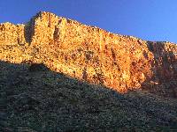
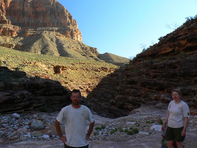
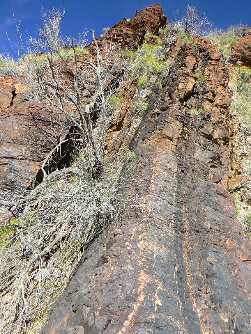
Day 3: Slate Serenade - Boucher to Slate
Creek. 5.5 miles; 9 ERM.
GPS total: 19.4 miles (5.5 today); descent of 6157' (746 today); ascent of 2597'
(1130 today).
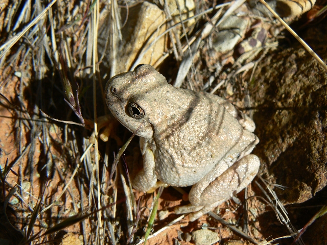
The croakers' serenade careens from the canyon walls.
Water - precious and life-enhancing water. We're relishing the shade of a rare juniper
where the vague Tonto Trail finally cruises into the Slate drainage.
Contemplating the fairly long pitch to Turquoise,
we wonder aloud about packing water to Agate to break the distance into more manageable
chunks. A protein bar and careful measurement with the wire from the GC permit and we see
that the good choice is to stay at Slate tonight and slog to Turquoise tomorrow.
Late afternoon and B., C., and 7 others who woke
us stomping into Boucher Camp long after sunset last night drag in to our miniscule shade.
Not looking good. After a break, most of the 9 head for the point to camp. B. has
vertigo issues and cannot proceed - the SAT phone is in play and the rangers say to the
9 "call in the morning and plan to walk out." Short story - it's the end of their jaunt
to South Bass. It's a terrible outcome after all their dreaming.
Natural quiet returns and a few romantic froggies
replace the intrusive drone of the air terrorists - supporting terror with each trip,
wasting fuel, polluting the air, causing higher medical costs due to obesity, ruining
the day, praise the lord. Night settles in like a down comforter.

|
|---|
Scylla Butte
(Click the image for a full-size view)
|
|---|
|
|---|
water in Sapphire
(Click the image for a full-size view)
|
|---|
|
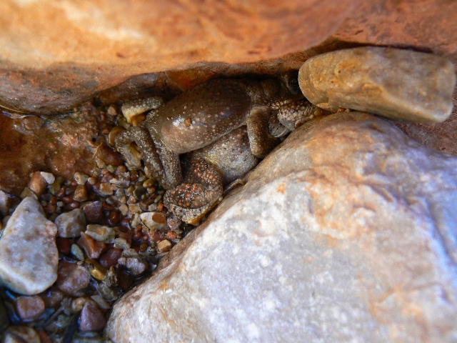
|
|---|
Froggie Crunch
(Click the image for a full-size view)
|
|---|
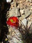
|
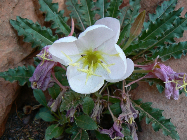
|
|---|
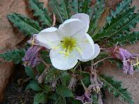
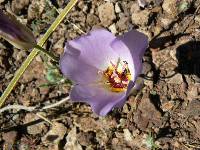
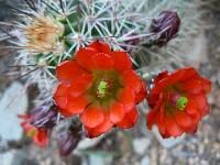
Primrose
(Click the image for a full-size view)
|
|---|
|
|---|
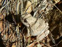
Canyon Tree Frog
(Click the image for a full-size view)
|
|---|
|
|
|---|
To Turquoise
(Click the image for a full-size view)
|
|---|
|

|
|---|
To Turquoise
(Click the image for a full-size view)
|
|---|
|
|
|---|
To Turquoise
(Click the image for a full-size view)
|
|---|
|
|
|---|
Turquoise Kitchen
(Click the image for a full-size view)
|
|---|
|
(There are - More photos below the trip narrative.)
Day 4: Torque to Turquoise - Tonto Dreaming
- Slate to Turquoise; 10.1 miles; 14 ERM.
GPS total: 29.5 miles (10.1 today); descent of 7357'
(1200 today); ascent of 3762' (1165 today).
The tinge of pink blushes softly across the tip
of Scorpion Ridge. Delightful. Frogs croak in with bursts of lust. Heat-driven gusts
attempt to float the tent down Turquoise Canyon to The River.
A fitting end to a day of Tonto Dreaming. Walking
the Tonto, I blink and the Tonto "Trail" is no more. Where? What? Calling the Tonto a
"Trail" in this section is like calling george w. bush a person interested in the rule of
law - it's more than a stretch of the term, it's just not true. A veracity-challenged
statement at the least.
Around points and into drainages, the Tonto plods
on and on. We arrive to lovely water in Turquoise.
Marvin of Bountiful arrives near sunset and later
Dean and Robyn of the NPS arrive and we chat about the Eastern 9 and wonder where they might
be. A wind and high cirrus clouds also arrive - and we get the wind. The moon is nearly
full and its pale glare illuminates our inner earth world.

|
|---|
Marvin at Turquoise
(Click the image for a full-size view)
|
|---|
|
|---|
Dean and Robyn at Turquoise
(Click the image for a full-size view)
|
|---|
|

|
|---|
Group at Turquoise
(Click the image for a full-size view)
|
|---|
|
|
|---|
To Ruby in the wind
(Click the image for a full-size view)
|
|---|
|
|---|
Ruby lobes
(Click the image for a full-size view)
|
|---|
|
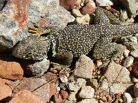
|
|---|
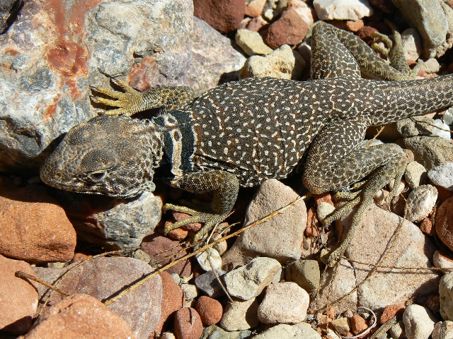
Mr. Lizard
(Click the image for a full-size view)
|
|---|
|
|
|---|
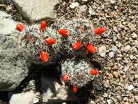
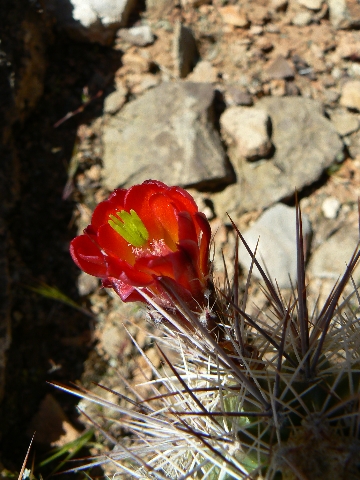
Ruby - cactus
(Click the image for a full-size view)
|
|---|
|
|
|---|
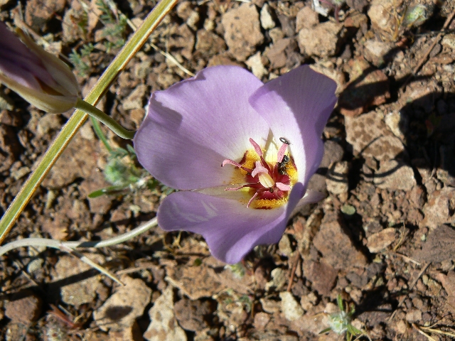
Ruby - mariposa
(Click the image for a full-size view)
|
|---|
|
|
|---|
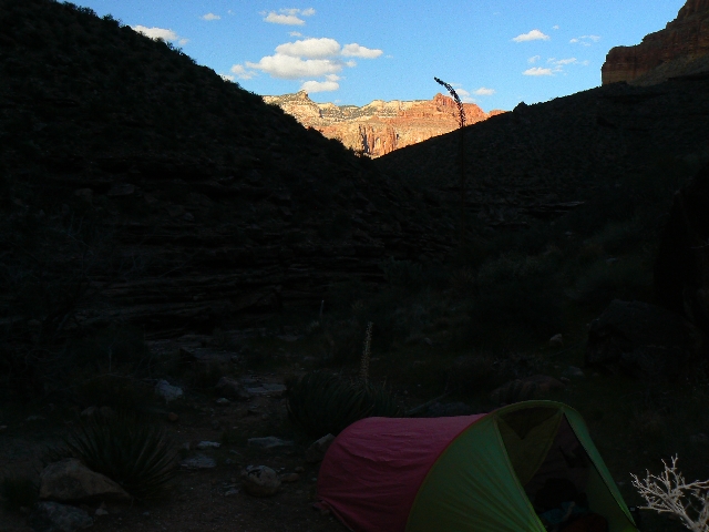
Ruby camp
(Click the image for a full-size view)
|
|---|
|
(There are - More photos below the trip narrative.)
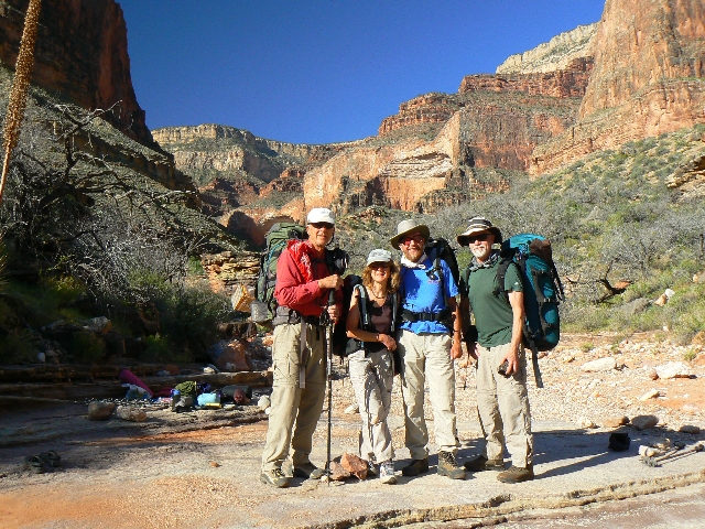
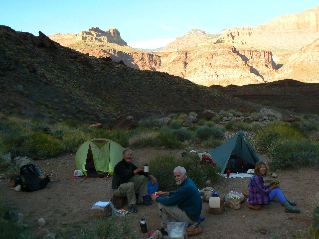
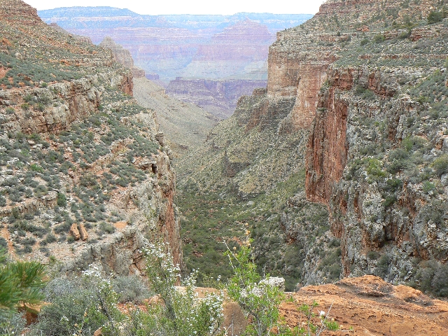
Day 5: Ruby Rapture! The alignment of Canyon
Karma Covariates and the Story of the South Bass! - Turquoise to Ruby; 7 miles,
12 ERM.
GPS total: 36.5 miles (7.0 today); descent of 8496'
(1239 today); ascent of 5017' (1255 today).
Morning dawns slowly in this deep dessert canyon.
The glow seeps in and I wonder, half aware, if it's moonlight or daylight, and does it
matter?
Around the morning pack stove, we wonder about the
route to the South Bass and "Click!" the karma consciousness ignites. We are here, Marvin
is here, the rangers are here, and the Easterners 9 are not. Our permit is for an out and
back to Hermit, with Turquoise as the terminus. The formulation of a plan comes together.
The conclusion is that Dean, of the NPS, alters our permit and Marvin's permit (so we can
camp at the TH when Marvin returns to get us - he started at S. Bass and has a truck at
Hermit's Rest). Marvin will get our cache at Boucher and come to get us at the top of S.
Bass. Yahoo.
Later today we meet 3 hikers who ask us to drive
their vehicle to Hermit's Rest from S. Bass TH. All is good.
We hike the Shaler and LeConte Plateaus sans the
horrible intrusive noise of air terrorists and in very wild conditions. Delightful.
Refreshing. The terrain is a bit difficult when we round through rock-choked drainages.
To Ruby, and this delightful narrow canyon with a good view of Sagittarius Ridge to the
North and the stunning escarpment of the Redwall Limestone on three sides. Early local
sunset and perhaps the cool front following the storm line make for a chilly evening - so
early to bed.
|
|---|
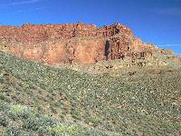
Day 6 - Great Scenic Divide
(Click the image for a full-size view)
|
|---|

|
|---|
shift in rocks
(Click the image for a full-size view)
|
|---|
|
|
|---|
bending rock
(Click the image for a full-size view)
|
|---|
|
|
|---|
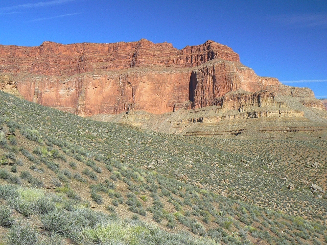
Bass Can Dike
(Click the image for a full-size view)
|
|---|
|
|
|---|
tadpole soup
(Click the image for a full-size view)
|
|---|
|

|
|---|
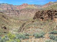
Bass historic camp
(Click the image for a full-size view)
|
|---|
|
(There are - More photos below the trip narrative.)
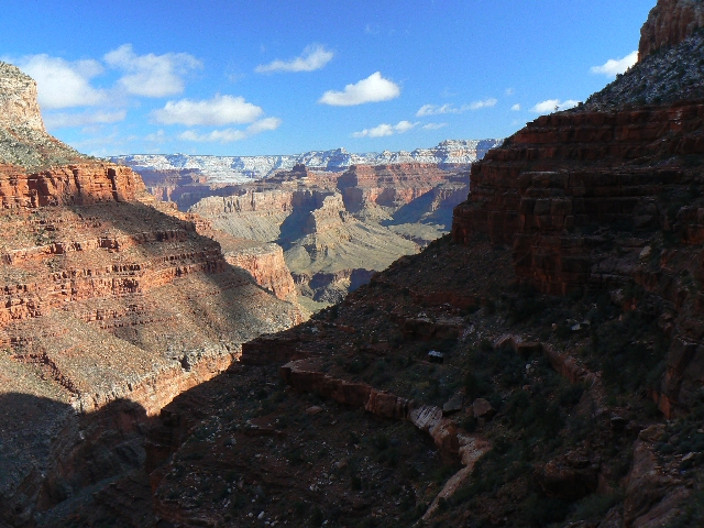
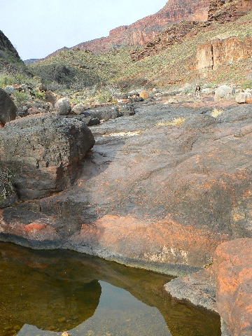
Day 6: Your Ass to Bass - Ruby to S. Bass
Historical Camp. 10 miles; 16 ERM.
GPS total: 46.5 miles (10 today); descent of 10227'
(1731 today); ascent of 6606' (1589 today).
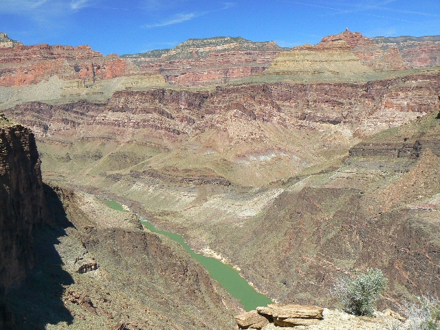
Suspended between the emerald ribbon far below and
the sheer red escarpment above, we walk the Tonto Trail on the stretch from Ruby to South
Bass Canyon. The Grand Scenic Divide looms, and we creep slowly toward then around it.
Again, we see people, albeit only two today.
Glorious. Somewhere along the way we cross Emerald Canyon, then Serpentine - which has
water of ill repute. So, on to Bass, where we hike down canyon and find pools of water
near what may be the site of the historic Bass Camp.
A huge slanted slab of naked metamorphic polished
bedrock graces the drainage and funnels water into the pot holes. Bring a line and a pot
to get water from the deepest pool because you might get in, but getting out is for
sticky-toed froggies only.
Winds calm, clouds float in and obscure the sky.
Is a storm imminent? Across the canyon, we wonder - is that the phallic spire of Set?
Chris' water filter grinds to a hose-popping halt.

|
|---|
Day 7 naked rock
(Click the image for a full-size view)
|
|---|

|
|---|
Chris on S Bass steps
(Click the image for a full-size view)
|
|---|
|
|
|---|
S Bass going out
(Click the image for a full-size view)
|
|---|
|
|
|---|
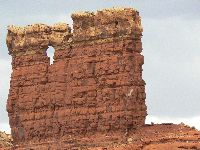
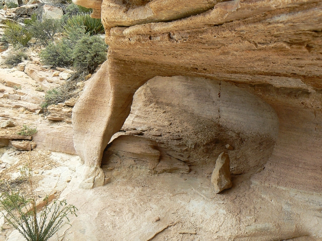
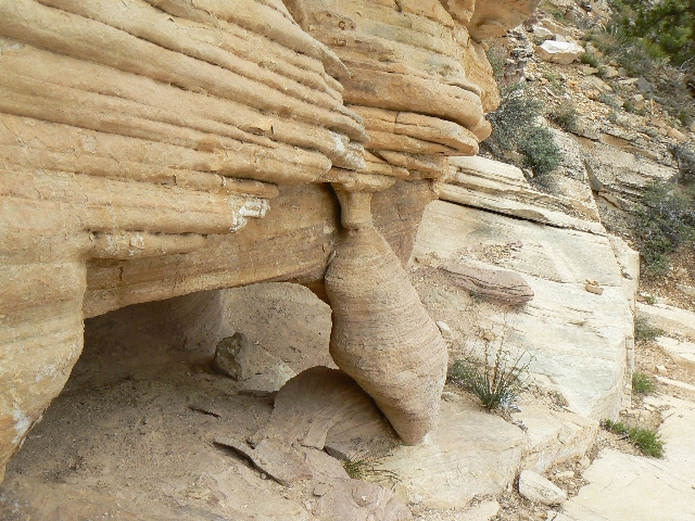
S Bass Arch
(Click the image for a full-size view)
|
|---|
|
|---|
S Bass Arch
(Click the image for a full-size view)
|
|---|
|
|
|---|
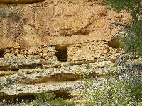
S Bass Pueblo
(Click the image for a full-size view)
|
|---|
|
|
|---|
S Bass Pueblo
(Click the image for a full-size view)
|
|---|
|
|
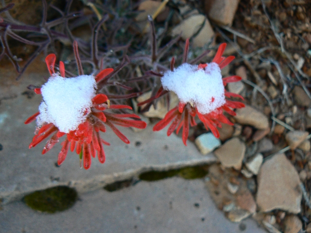
|---|
bloom follows the snow
(Click the image for a full-size view)
|
|---|
|
|
|---|
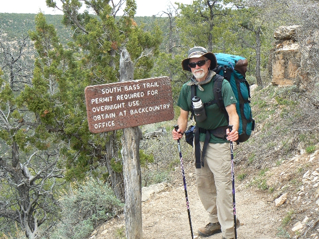
Zig at the TH
(Click the image for a full-size view)
|
|---|
|
Day 7: Bassamatic Engineering - S. Bass
Historical Camp to S. Bass TH. 6.3 miles; 13 ERM.
GPS total: 52.8 miles (6.3 today); descent of 10446'
(219 today); ascent of 9766' (3160 today). Total ERM - 91.
The stone steps punctuate the engineering skill that
is the South Bass Trail. Hardly any elevation loss over 6+ miles and about 3200' of elevation
gain. Astounding.
It's a gray day as we march up the Bass - a real
treat compared to other GC trails - quiet, well engineered, with steps designed for people,
not pack animals. Of course, we feel some like pack animals, and I must be the mule. A
delightful bench interrupts the ascent between the Supai and Coconino, and the trail wanders
through Pinon Pines. Sylvan. A small arch near the top of the Coconino layer and a pueblo
ruin near the bottom of the Toroweap add zest to an already alluring climb.
Continuing gray skies and biting winds are
unrelenting at the TH as we contemplate camping at the TH - deciding to go out before the
storm, and making contingency plans to not miss Marvin, who is on his way in to meet us
(but does not know we were given car keys for a vehicle to shuttle back to Hermit).
It's a 30+ mile dirt and sometimes clay (dry for now)
road and we meet Marvin at the reservation boundary. More vehicle switching, a quick dinner
at the cafeteria, and we're traveling home. Zig, Marvin, Kathleen, and I continue on as
Chris heads for Smog Lake.
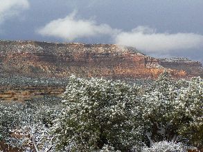
Snow settles over the plateau tonight.
Postscript - A most excellent adventure, albeit the cache
remains at Boucher. Zig tries for a quick permit to retrieve the cache, but there is
nothing available until late May. Damn - I guess we'll have to schedule another jaunt
into The Canyon.
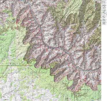
Links:

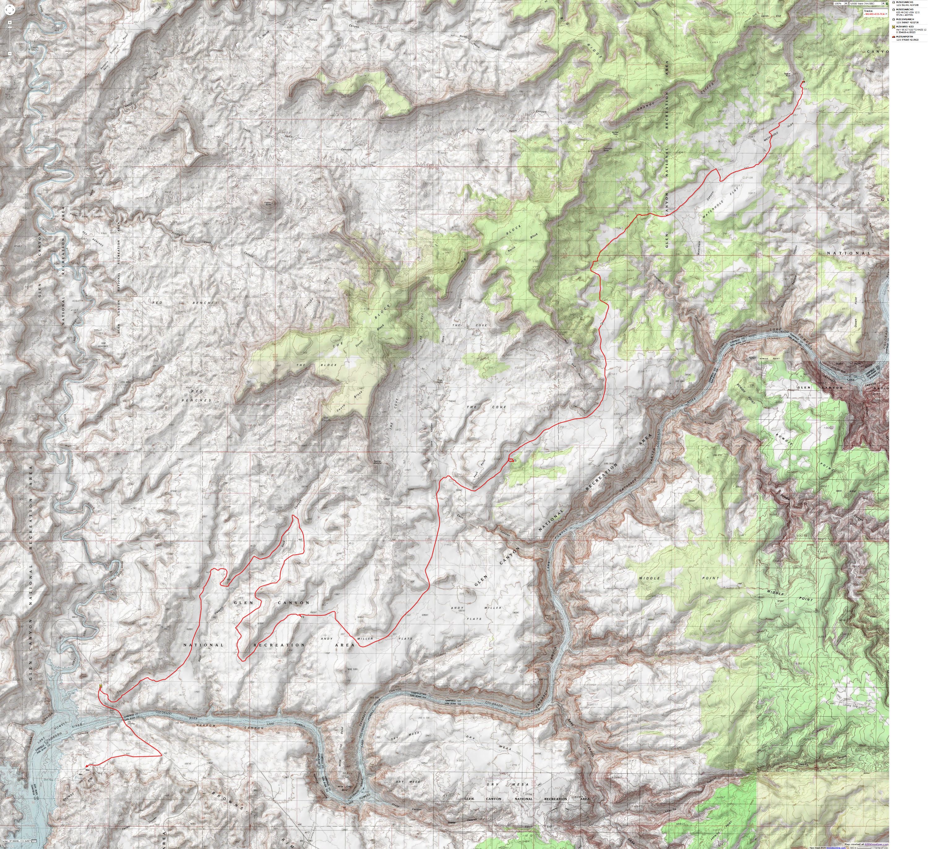
Maps:


|
|---|
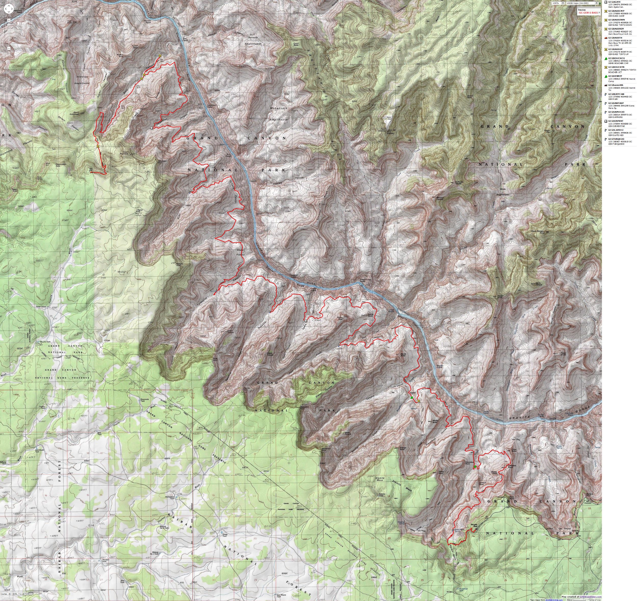
Map - GC: Gems: Hermit to South Bass; 2009; 53 miles
(Click the image to see the map)
|
|---|
|
for a full-resolution map, click here. Caution - do not use this map or gps track for
navigating the route.
Other WV reports about the Grand Canyon:
Click here or on the Looking Lizard to go to all WV reports about The Grand Canyon

|
|---|
Looking for All Wilderness Vagabond trip reports about the Grand Canyon?
Click the image to go to All WV reports about The Grand Canyon
|
|---|
|
Closing remarks:
Part 1: restore natural quiet in the Grand Canyon
An open letter to:
Steve Martin, Superintendent
Grand Canyon National Park
P.O. Box 129
Grand Canyon, AZ 86023
Superintendent Martin,
I wrote to the FAA after a visit to the Grand Canyon in the 70's, and I was told that
a decision to deal with intrusive air tours was imminent. Nothing much positive has
happened, and air tours routinely and frequently (nearly constantly during daylight)
destroy natural quiet in the park and surrounding public lands. I am writing to request
that you immediately (please, not another 30 years of delays!) work toward restoring
natural quiet in the park and surrounding public lands. National security and public
health issues are also important, and these are briefly reviewed below. There is
essentially no valid support (except private profit as it relates to political arm-twisting)
for air tours within a national park, being an anathema to the mission and purpose of the
National Park Service. I urge you to completely eliminate air tours from Grand Canyon
National Park. You will undoubtedly reply that this is politically "impossible." However,
in support of natural quiet, the continuity of the Park, national security, and global
health, I urge you to begin the appropriate containment and speedy elimination
of intrusive air tours. Please:
1. Finite Number of Tours - Put a permanent cap on the number of air tour rides over
Grand Canyon National Park. The number of flights should be at one-half the level it was
when Congress first addressed Park aircraft noise — 1975. Then, phase out air tours to
zero - over the next 3 years.
2. Curfews - The existing early morning and late evening curfews are as short as 14
minutes; they should be expanded to a minimum of 3 hours morning and 3 hours evening.
One morning and evening hour of curfew should be added each year until air tours are
eliminated.
3. Flight Free Zones - The area of flight free zones should be increased until natural
quiet is substantially restored every day of the year. See above.
4. Quieter Technology - A transition to quieter technology should be part of the
solution. Quieter technology aircraft are commonly used in Europe. We should phase out
aircraft not having the latest quiet technology over the next year.
5. Altitude Limits - all aircraft (except rescue craft or NPS craft on essential
missions) should maintain a minimum altitude of 3,000' above the level of the North Rim.
Departure/Approach should occur over private land. Wild (unroaded) National Forest and
other public lands should not become the location of displaced air tour noise and intrusions,
so altitude and flight limits should also apply over these lands.
6. National Security - Air tours consume huge amounts of precious and limited fossil
fuels. This is a national security issue, and encourages/supports terrorism. All
governmental agencies should be involved in making us independent of coercion based on
fuel supplies. Reducing and eventually eliminating air tours should be part of these
efforts. The views from the rim are easily accessible to visitors in a hurry, or visitors
lacking the energy or physical capacity to hike the inner canyon. Of course, with the
reduction of air tours - an added bonus is that visitors might enjoy the natural quiet
in addition to the spectacular scenery.
7. Global Warming - The end of Nature? Yes, there is little doubt that air tours
contribute too much in the negative to this profound and universal problem.
Reducing/eliminating air tours is a good thing, globally and locally.
8. Public Health Issues/national debt - Air tours should be viewed like smoking.
Smoking causes medical problems for all who are exposed, willing participants or not.
Air tours encourage visitors to become more sedentary, increasing public/private health
care costs, decreasing productivity and causing untold stress to the nation and to families.
Air tours intrude into the health of those not willingly participating in this waste of
fuel and destruction of natural quiet and harmonious experience with the natural world.
Air tours add significantly to stress because of their intrusive, irritating noise and
visual pollution. Air tours (like smoking) should be restricted to private land where
people voluntarily participate in the devastation of their health and personal (not public!)
resources.
Part 2: We Are Breeding Ourselves to Extinction
We Are Breeding Ourselves to Extinction (click here for full article)
All measures to thwart the degradation and destruction of our ecosystem will be useless
if we do not cut population growth. By 2050, if we continue to reproduce at the current
rate, the planet will have between 8 billion and 10 billion people, according to a recent
U.N. forecast. This is a 50 percent increase. And yet government-commissioned reviews,
such as the Stern report in Britain, do not mention the word population. Books and
documentaries that deal with the climate crisis, including Al Gore’s “An Inconvenient
Truth,” fail to discuss the danger of population growth. This omission is odd, given
that a doubling in population, even if we cut back on the use of fossil fuels, shut
down all our coal-burning power plants and build seas of wind turbines, will plunge
us into an age of extinction and desolation unseen since the end of the Mesozoic era,
65 million years ago, when the dinosaurs disappeared.
We are experiencing an accelerated obliteration of the planet’s life-forms—an estimated
8,760 species die off per year—because, simply put, there are too many people. Most of
these extinctions are the direct result of the expanding need for energy, housing, food
and other resources. The Yangtze River dolphin, Atlantic gray whale, West African black
rhino, Merriam’s elk, California grizzly bear, silver trout, blue pike and dusky seaside
sparrow are all victims of human overpopulation. Population growth, as E.O. Wilson says,
is “the monster on the land.” Species are vanishing at a rate of a hundred to a thousand
times faster than they did before the arrival of humans. If the current rate of extinction
continues, Homo sapiens will be one of the few life-forms left on the planet, its members
scrambling violently among themselves for water, food, fossil fuels and perhaps air until
they too disappear. Humanity, Wilson says, is leaving the Cenozoic, the age of mammals, and
entering the Eremozoic—the era of solitude. As long as the Earth is viewed as the personal
property of the human race, a belief embraced by everyone from born-again Christians to
Marxists to free-market economists, we are destined to soon inhabit a biological wasteland.
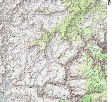
Next, the
after-backpack snow-bound excursion in The Maze, near Teapot Rock
April 14-16, 2009
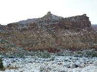
|
|---|
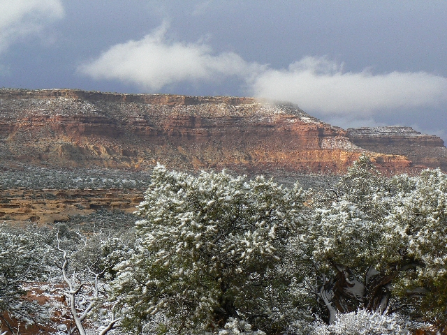
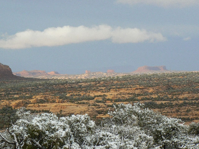
Dusted Orange Cliffs
(Click the image for the full-size image)
|
|---|
|
|
|---|
Map - UT: Canyonlands - Maze; 2009; Hite to Teapot - driving
(Click the image to see the map)
|
|---|
|
for a full-resolution map, click here. Caution - do not use this map or gps track for
navigating the route.
 Click here to see a short clip of the
Horizonal snowstorm at Teapot Rock. Click here to see a short clip of the
Horizonal snowstorm at Teapot Rock.
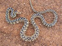
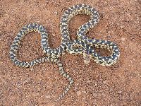
Day 1: Resilient Reptile Drive to Teapot Rock,
The Maze District.
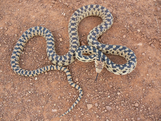
The lean, long juniper root straggles across most of
the Waterhole Flat Road, Road 633 from near Hite to THE Maze from the South. Yikes - that's
a snake, not a root, I exclaim to myself as I slide the truck tires a bit and succeed in
straddling the snake, then stop and go to see if it's really a snake.
Yes, and a very upset snake, judging by the hissing
and false striking when I attempt to herd her off the road. She's probably a bit cool and
grumpy, why, I'm cool and grumpy standing out in this wind.
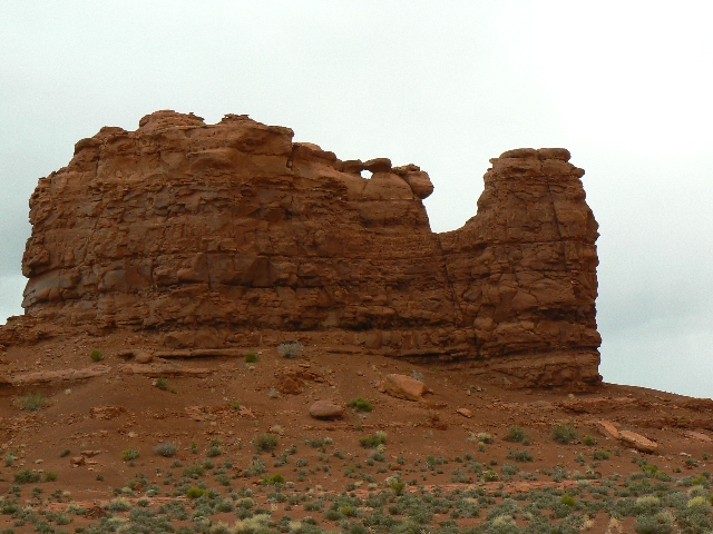
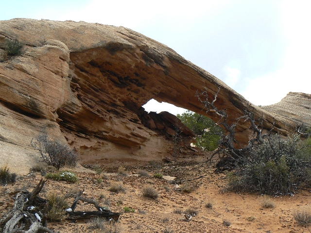
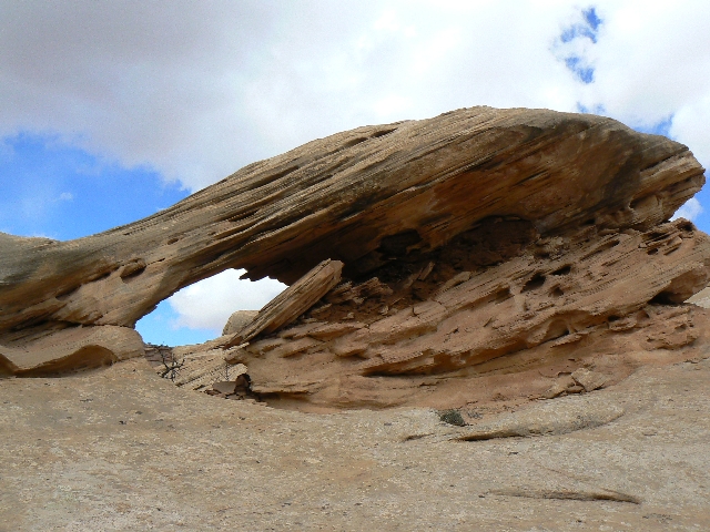
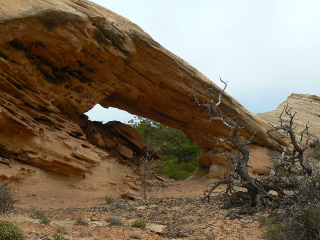
I've found a few arches along the way - including
Cove Arch.
Earlier - I stop at Hite and locate the pay phone
near the unmanned R.S. to call Hans Flat for completion of my backcountry permit, which
is difficult with the rising gale. I laugh at the low level of the sewage pond - victim
of a drought created by overpopulation of this, our only Earth. No refunds.
Bumping to a total of 38 miles from Hwy 95, I'm
about 3 miles along the Teapot Rock Rd. which eventually leads to the Doll House, when I
decide I've gone about a half a mile too far and find a wide spot in which to park.
Fierce winds rock and tilt the truck as I try to
sleep. No rain - at least not yet.
Day 2: Listless Blast-out.
I'm hiding out in my big red raincoat and windbreak,
my small red truck. A non-productive mud storm forces me to abandon my rally to start
hiking. All day, gale-force winds, icy and promising, but not delivering rain or snow,
have rocked the vehicle and blown away my hat.
Glipses of Standing Rocks to the NE are rare. I
invest a couple of hours marking approximate locations from the WAD onto my topo quads.
Two vehicles leave - the last reporting that the
area is empty of people and describing how the winds scooped sand under the tent fly - to
come raining down on their faces and such. Brutal. Yet, it's better than tax day in town.
As I write these notes, a horizontal snow storm
ensues. Yikes.
Yikes indeed. I gave up cowering from fierce
storms and headed home, vowing to try again later.
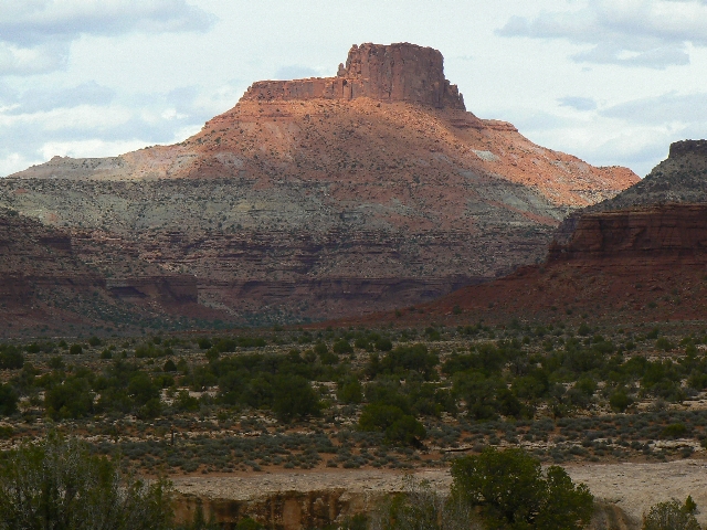
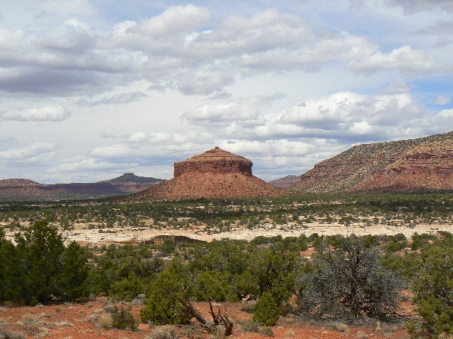
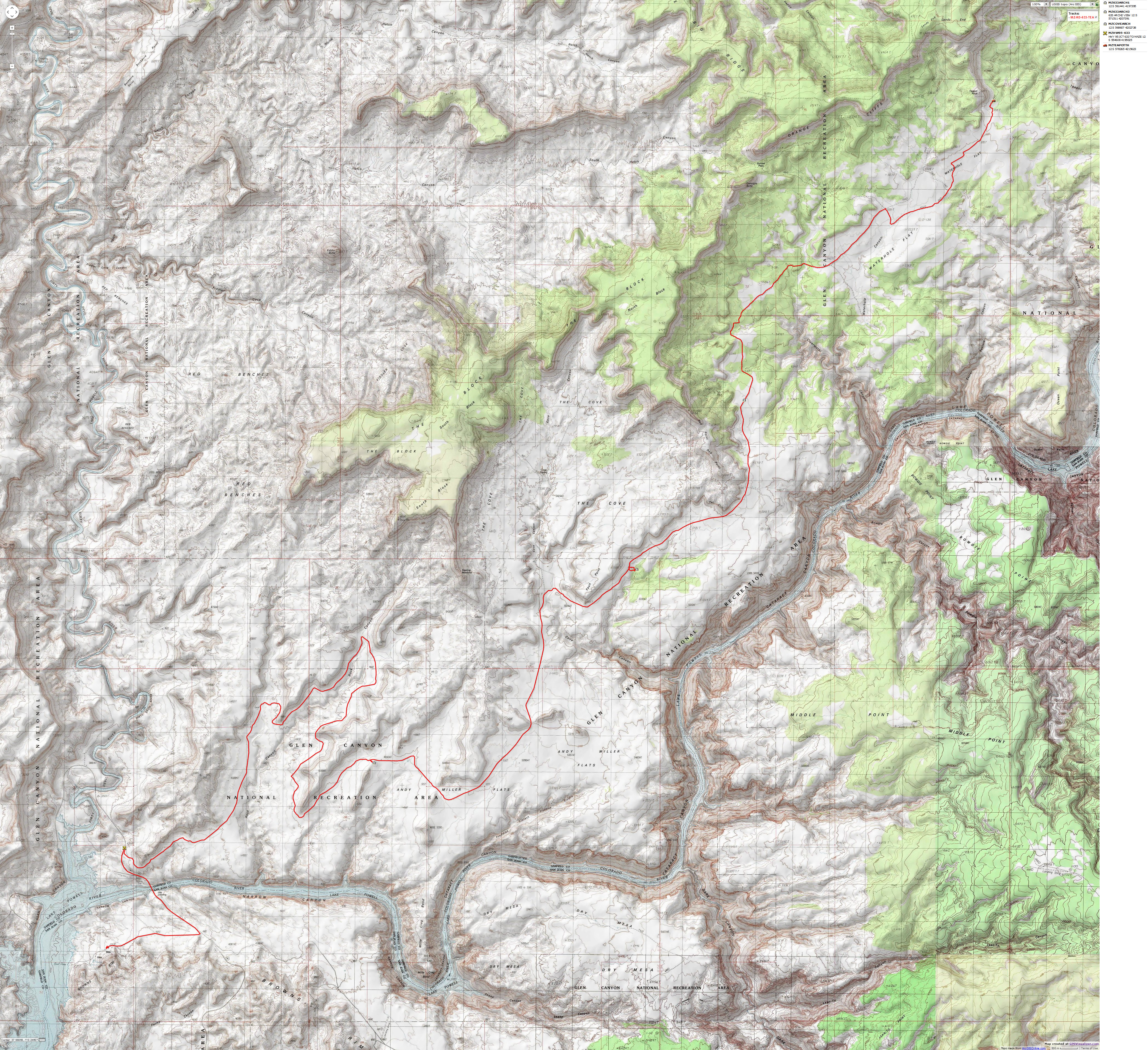
Arches on Rd 633, from near Hite to The Maze:
Starting at MP 46.4 on Hwy 95, at the top of the hill
climbing out above the bridge over the Colorado River and headed for the Dirty Devil
Bridge (if you reach the Dirty Devil Bridge, turn around -you have gone too far), drive
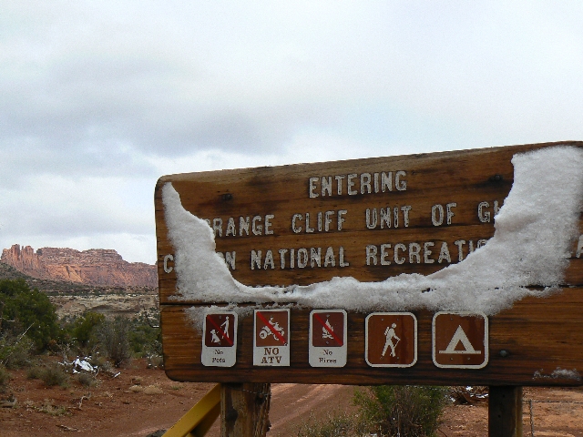
North onto Road 633, which travels to the Orange Cliffs area of The Maze District of
Canyonlands NP. MP 0 for Hwy. 95 is at Hanksville, Utah.
Set your odometer to zero (0) when you leave Hwy 95. See the
map above.
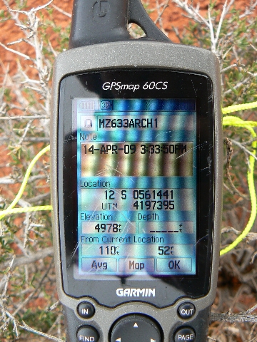
Maze 633 Arch 1 is on your right at 13.6 miles from Hwy 95.
GPS coordinates are roughly:
UTM 12 S 561441E; 4197395N; WGS84
Maze 633 Arch 2 can be seen from the car park for Arch 1, and
is another mile and a half up the road.
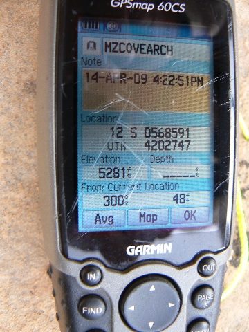
Cove Arch is on your right at 21.4 miles from Hwy 95. Pull
off on the slickrock on your right, and look just below your level and about 600 feet to
the East for Cove Arch. GPS coordinates for Cove are roughly:
UTM 12 S 568607E; 4202738N; WGS84
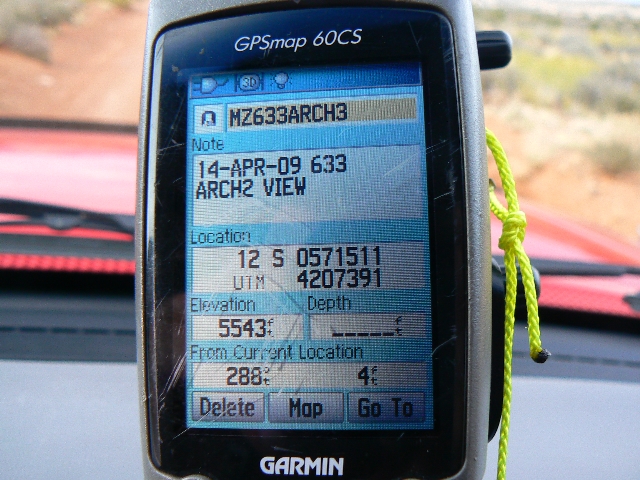
Maze 633 Arch 3 is on your left at 25.5 miles from Hwy 95.
GPS coordinates for the carpark to view this arch are roughly:
UTM 12 S 571511E; 4207391N; WGS84
|
|---|
resilient reptile
(Click the image for a full-size view)
|
|---|
|
|---|
Unhappy to leave the road
(Click the image for a full-size view)
|
|---|
|
|
|---|
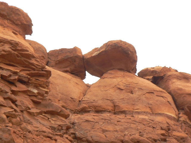
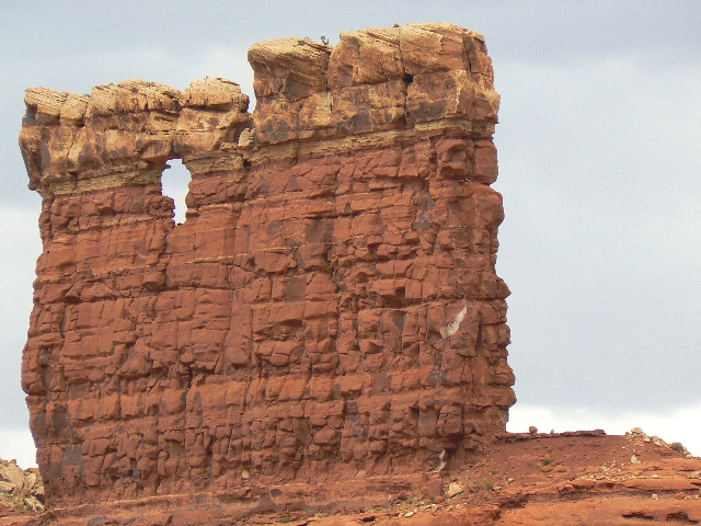
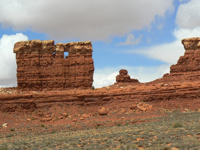
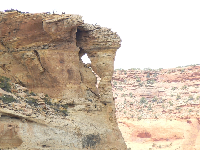
Maze 633 Arch1
(Click the image for a full-size view)
|
|---|
|

|
|---|
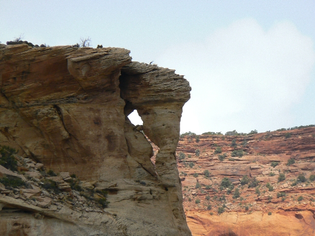
Maze 633 Arch1
(Click the image for a full-size view)
|
|---|
|
|
|---|
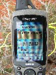
Maze 633 Arch1 GPS
(Click the image for a full-size view)
|
|---|
|
|
|---|
Maze 633 Arch2
(Click the image for a full-size view)
|
|---|
|
|
| | | | | | | | | | |


