|
|---|
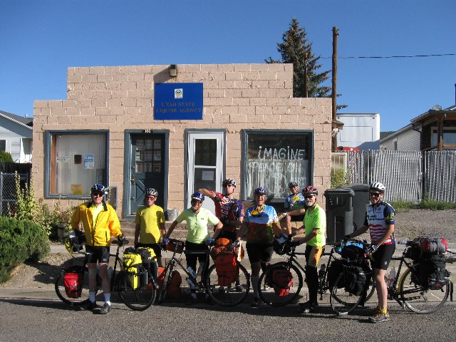
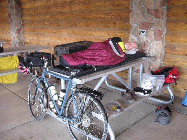
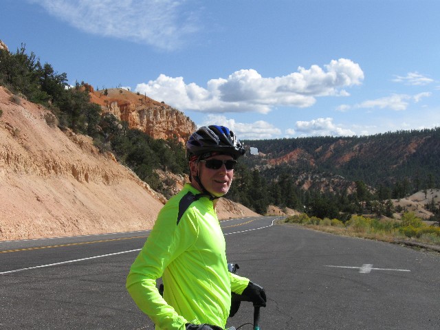
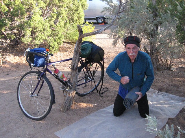
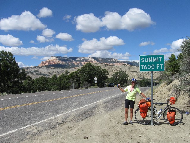
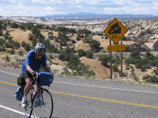
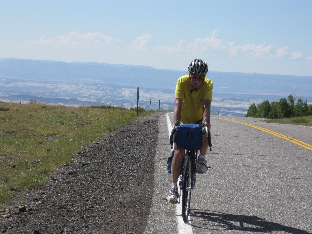
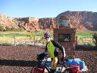
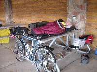
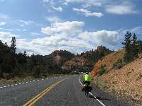
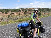
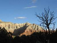
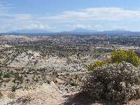
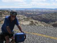
Day 1 Start the ride!
(Click the image for a full-size view)
|
|---|
|
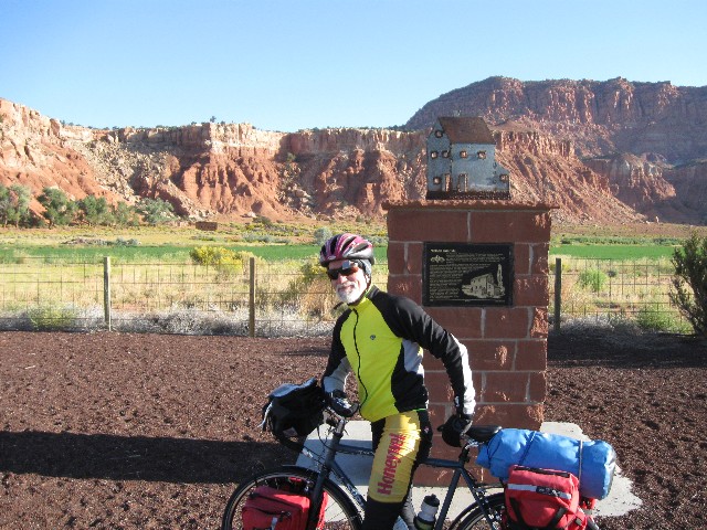
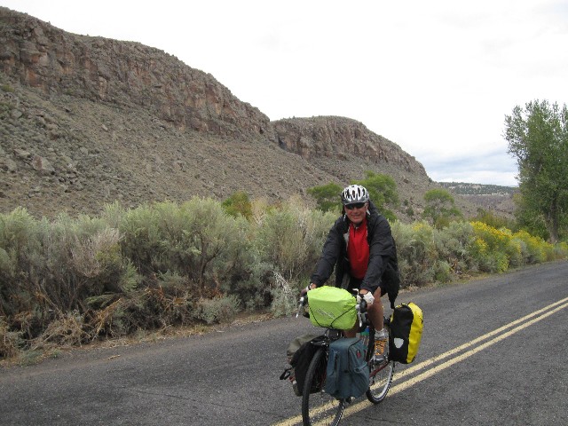
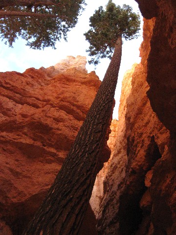
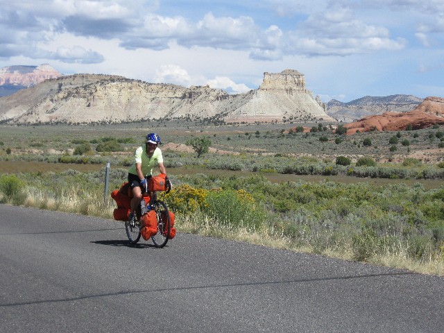
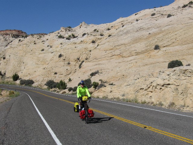
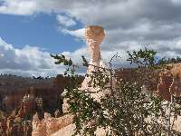
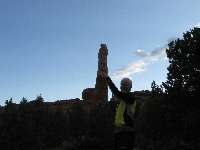
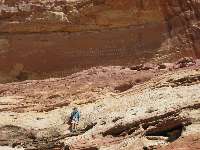
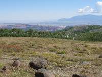
|---|
Zig near Capitol Reef
(Click the image for a full-size view)
|
|---|
|
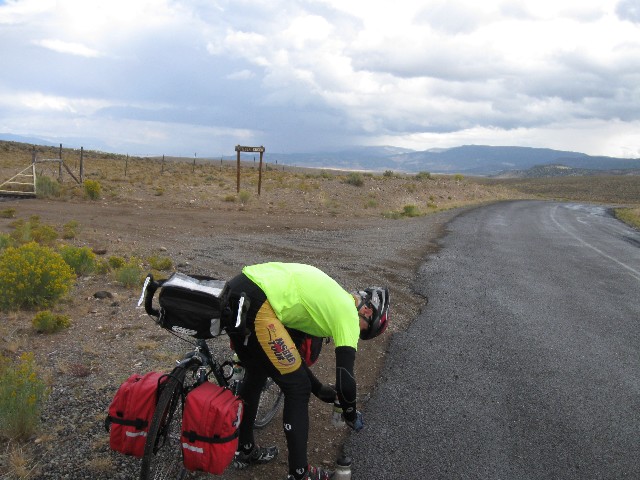
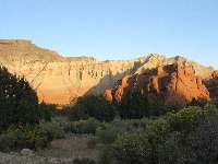
|
|---|
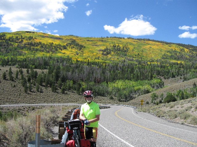
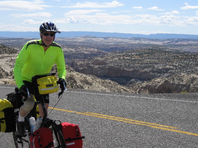
Zig - Fish Lake Climb
(Click the image for a full-size view)
|
|---|
|
|
|---|
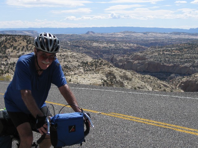
Dave - Fish Lake Climb
(Click the image for a full-size view)
|
|---|
|
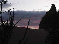
|
|---|
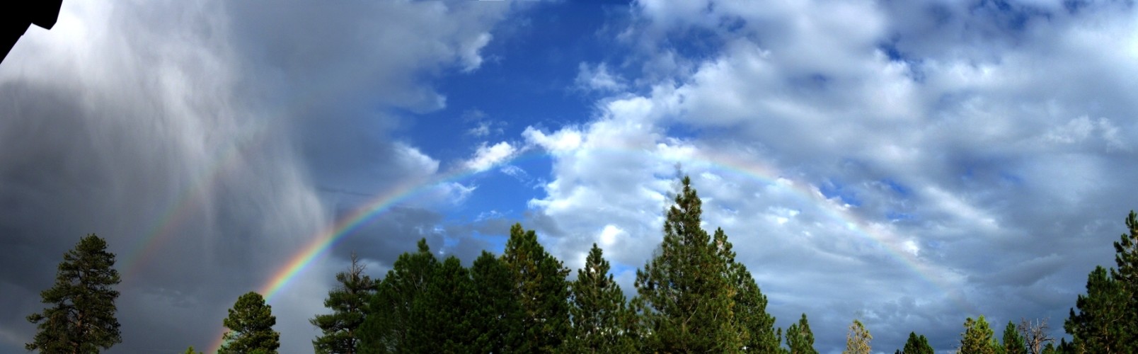
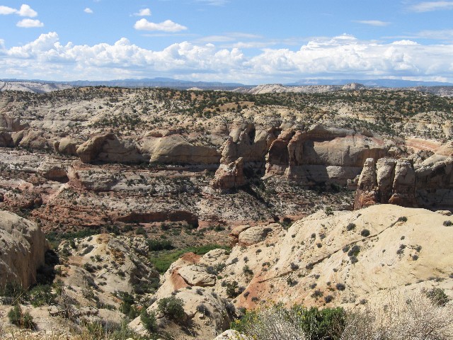
Fish Lake Climb Colors
(Click the image for a full-size view)
|
|---|
|
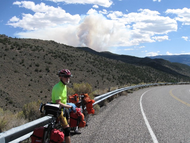
|
|---|
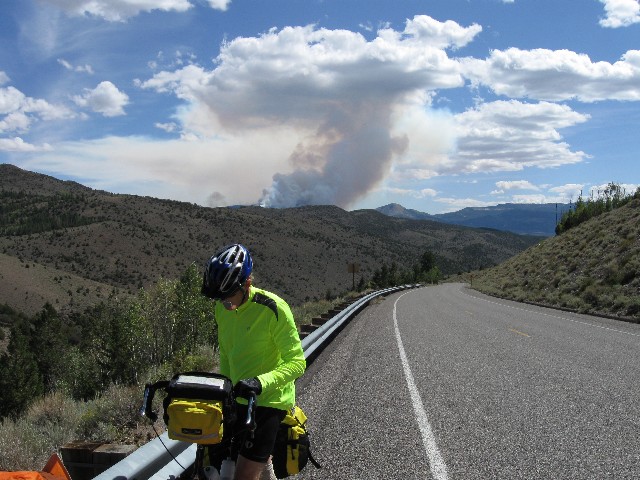
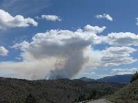
Wild Fire blow-up
(Click the image for a full-size view)
|
|---|
|
69 photos (and 2 panos) are scattered throughout this report.
Keep scrolling.
First - A Summary by the Tour Organizer
Southern Utah Pannier Bike Tour
by Dave Rumbellow
From pg 19 of the November issue of The Ramble, Wasatch Mountain Club
This trip was a one week self-supported camping bike tour of Southern Utah. Panniers or bike trailers were used by all participants to carry their gear, and there was no vehicle support. It was about a 250 mile loop starting and ending in Torrey, Utah, and following the same route as Cheryl Soshnik’s tour of last year.
Our schedule was as follows:
Sat Sept 12 Torrey to Fish Lake, camp at Fish Lake
Sun Sept 13 Fish Lake to Otter Creek, camp at Otter Creek
Mon Sept 14 Otter Creek to Ruby’s at Bryce Canyon , camp at Ruby’s
Tue Sept 15 layover day, camp at Ruby’s
Wed Sept 16 Bryce to Kodachrome State Park, camp at Kodachrome State Park
Thur Sept 17 Kodachrome to Escalante State Park, camp at Escalante State Park
Fri Sept 18 Escalante to Boulder, camp in Boulder
Sat Sept 19 Boulder to Torrey
The ride was good with plenty of long steep hills and good riding conditions for the most part. We
did have some strong headwinds and a bit of rain going from Fish Lake to Otter Creek and from
Otter Creek going to Ruby’s at Bryce. Some of us went hiking in Bryce Canyon National Park on our
layover day where we visited Wall Street and Queens Garden from Sunset Point. There was a ranger
talk at Kodachrome State Park where we looked through the ranger’s telescope at such objects as the
Ring Nebula, the Andromeda Galaxy, four of the moons of Jupiter, etc. In Boulder we ate pizza for
dinner while listening to open mike songs at the Sinclair gas station and mini mart. All in all it was a
successful trip.
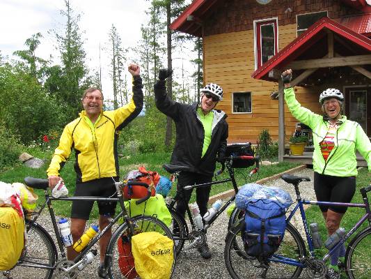
Participants: Dave Rumbellow, Zig Sondelski, Cheryl Soshnik, Rob Jones, Randy Burns, Rob Paull,
Tiffany Mercer, Don Vincent.
Now - Rob's report, starting with ---> Prologue: The night prior to the bicycle event finds me dodging black cows and darting deer as I roll in the deepening dark over Boulder Mountain on the way to meet Zig and Dave in Torrey. Yikes.
This is a report of 268 miles of self-contained bicycling in Central Utah. It was initially scouted by Cheryl S. and Randy B., and organized this year by Dave R. Other riders include Zig S., Rob P., Tiffany M., Don V. (Vince), and me (eight total, all self-contained). Utah is known for tremendously terrific terrain and unabashed backward outlook. Acknowledge the land, then overpopulate it as quickly as possible. We eight took the more ethical tour, self-contained (and without any support vehicles).


|
|---|
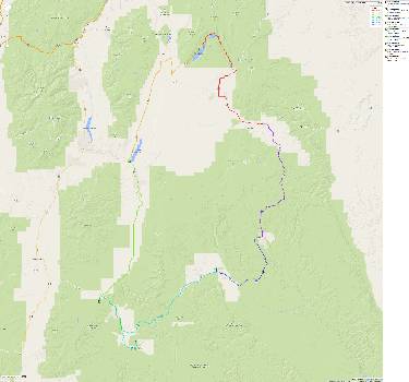
Map - UT: Bike Tour; 2009; 268 miles
(Click the image to see the map)
|
|---|
|
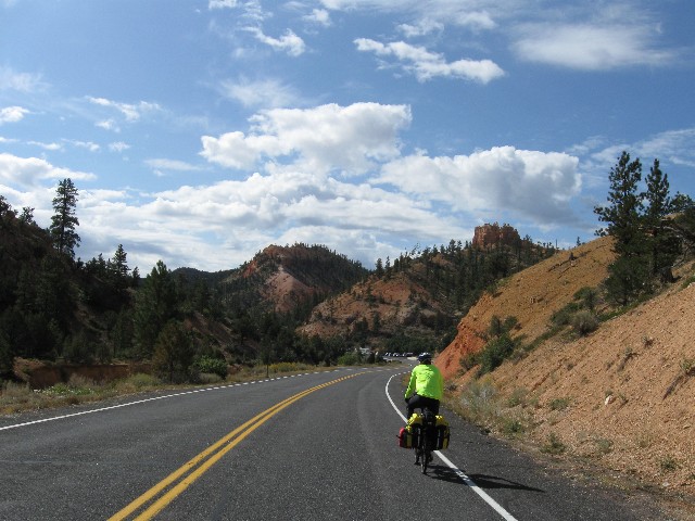
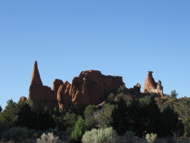
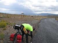
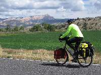
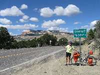
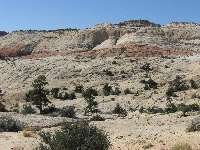
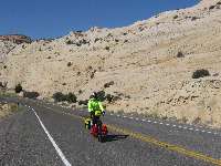
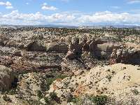
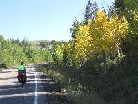
Day 1: Topping Torrey:
Torrey to Fish Lake; 43.5 miles, 3275' elevation gain; 1800' elevation loss. Camp at 8500'
The Aspen leaf flutters past as I waver, nearly flopping onto the tarmac. Too slow for the cyclo computer to register. Argh. Pains shooting from the left knee remind me I probably need (another) regearing of the trusty VM (Venerable Monster, the Specialized Expedition long-distance touring bicycle). Somewhere, is the top of this climb toward Fish Lake.
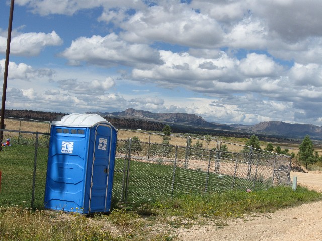
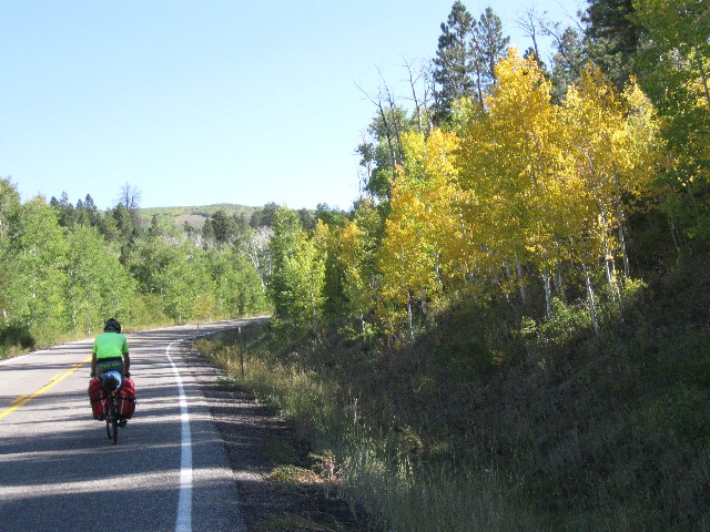
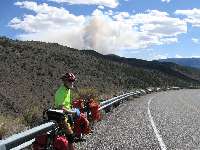
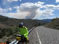
Starting out in the wind from Torrey, I pause for a scenic toilet photo. There is lots of wind to Bicknell, then warming and a bit more calm. Those of us starting at Torrey meet the rest of the group in front of the tiny liquor store in Bicknell. Out of Fremont, the hills begin and continue, continuing on. Aspens aglow on a side hill contrasts with the inky black of smoke from a blow-up of the forest fire to the East.
Finally, a down hill across the Fremont River - yet the crosswinds buffet - making caution rather than speed the rule of the day. Then, more uphill. Finally, a fairly comfortable lilt the final eight miles to Fish Lake - yet by now the left knee is protesting any movement.
We camp at Bowery Creek FS camp. Most of us drift back to the lodge for a steak dinner and an exhausted end to a good first day of riding.
Cheryl says this is the second most difficult day of the tour, eclipsed by the day over Boulder Mountain (Day 8). Rain patters dot the evening.
|
|---|
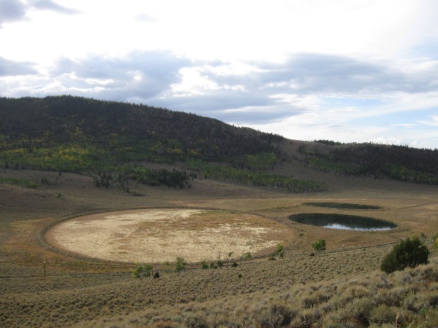
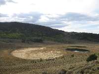
Day 2 - curious circles
(Click the image for a full-size view)
|
|---|
|
|---|
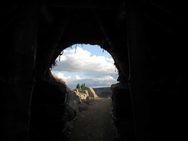
Inside pit house reconstruction
(Click the image for a full-size view)
|
|---|
|
|
|---|
Zig - out at Otter Cr. Res.
(Click the image for a full-size view)
|
|---|
|
There are - More photos below the narrative.
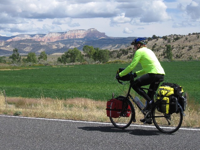
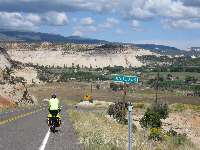
Day 2: Grass Valley Grunt:
Fish Lake to Otter Creek SP (state park); 44.5 miles, up 1100'; down 3500'; camp at 6400'. (88 total miles.)
The wind ripples through the saturated yellow fluff heads of Rabbitbrush, which blooms in the Fall across the high desert. Then, shards of nearly-horizontal rain spackle across the road, stinging my legs. Yikes, what else can be added to this easy day gone hard? At least the First Law of Bicycling holds - the wind is always in your face. Law Two has not held today - What goes down must go up (a unidirectional law). Plowing Grass Valley has proven to be more than a lilt.
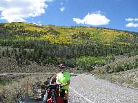
The ride up out of the Fish Lake Basin was punctuated by a few early-blooming Fall Aspens. And, this well-graded climb is followed by the 40 MPH howl downhill to the junction, to the turn toward Koosharem. We enjoy a restful stop at the Koosharem school, and note the start of a building breeze as we lounged.
We're camped in the pavilion at Otter Creek SP, near 6400' - quite a contrast to the 9000' summit near Fish Lake this morning.
Rob P. and I outran most of the storm, followed by a deadly calm feeling. Booming of the electrical grid punctuated this calm. After we deposited bike et al., in the pavilion, it rained while we walked across the way and enjoyed a chicken sandwich followed by more showers and an alfredo spaghetti dinner. Again, we are graced by the low bellow of a winnehogo generator this evening.

|
|---|
Day 3 Randy & Antimony climb
(Click the image for a full-size view)
|
|---|
|
|---|
Zig -rain prep
(Click the image)
|
|---|
|

|
|---|
Bryce toilet view
(Click the image for a full-size view)
|
|---|
|
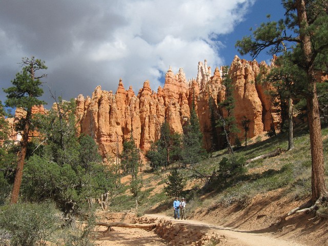
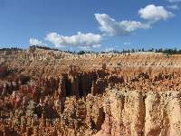
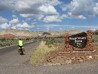
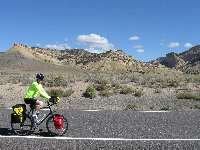
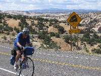
Day 3: Rain Winder:
Ottter Creek SP to Bryce Canyon entrance; 44.5 miles; up 2571'; down 1580', camp at 7500'. (132.5 total miles.)
Thunder booms, silencing the wicked wind from the South. An enervating wind has plagued us since climbing out of the volcanic-cliffed canyon upstream of Antimony. Ah, and it is a lovely tour out from Antimony to the grist mill, then up sharply and into the wicked wind.
Hiding under a lone Ponderosa worked out well for the first duo of showers. Venturing out, again it started raining. Not a bad trade - a bit of rain for lower velocity wind. This is a good thing because my strength is ebbing. Randy, Zig, Dave, and I form a ragged pace line, drifting like a chevron of drunk geese in the unrestrained wind. This pacing helps a great deal, yet it's still difficult to keep riding. The others sprint ahead and I tour slowly into the area just outside the park (Ruby's Inn, outside Bryce Canyon NP).
I park the VM under a bank of exhaust ports from the commercial dryers in the campground. A convection of warm air envelopes me, wet raingear, and the VM. Deluxe!
Later, Zig, Dave, and I go the last of the lunch buffet and gorge on a gloriously gluttonous protein load. We stay long enough that the dinner fare is brought from the kitchen, and we enjoy it too. The shower is most excellent too. Sprinkles drive us into our tents just after sunset.
|
|---|
Day 4 Bryce Respite
(Click the image for a full-size view)
|
|---|
|
|---|
Tiffany checks photo
(Click the image)
|
|---|
|
|
|---|
Germans stroll Bryce
(Click the image for a full-size view)
|
|---|
|
|
|---|
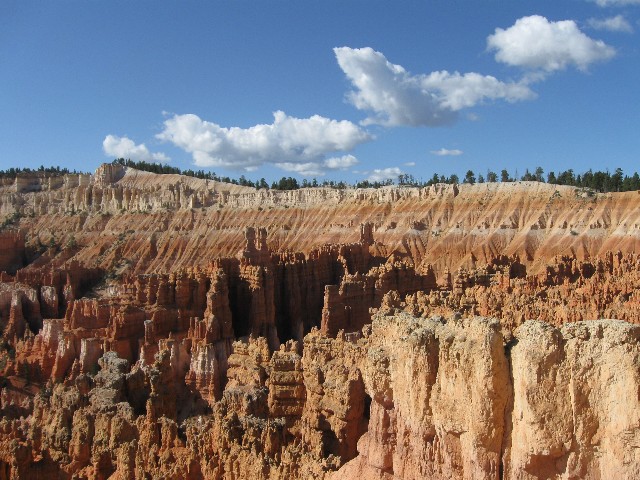
Rob P points to THE Wall Street
(Click the image)
|
|---|
|
|
|---|
Titans of the Real Wall Street
(Click the image for a full-size view)
|
|---|
|
|
|---|
Titans of the Real Wall Street
(Click the image for a full-size view)
|
|---|
|
|
|---|
ET and Bristlecone
(Click the image)
|
|---|
|
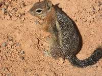
|
|---|
Golden-mantled Ground Squirrel
(Click the image for a full-size view)
|
|---|
|

|
|---|
Queen of the Garden
(Click the image for a full-size view)
|
|---|
|
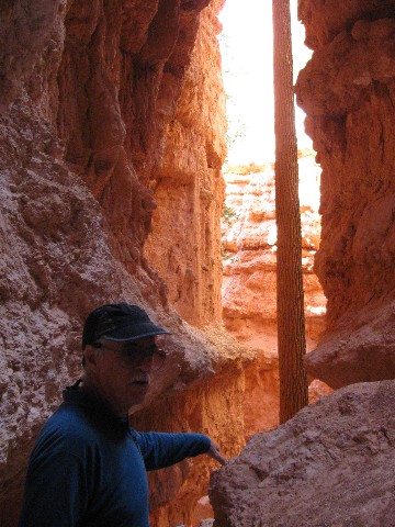
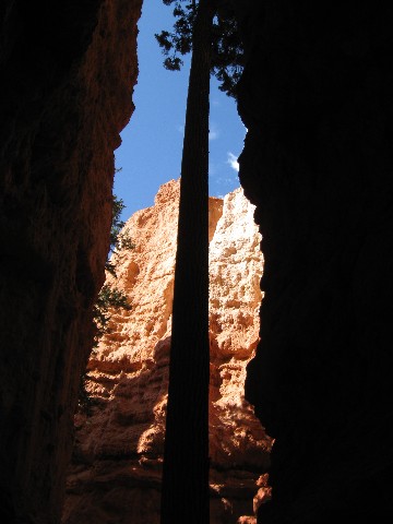
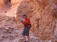
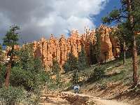
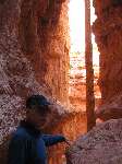
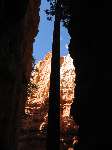
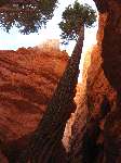
Day 4: Butt-rest Bryce. : 0 miles on bike, 5 miles trail walking
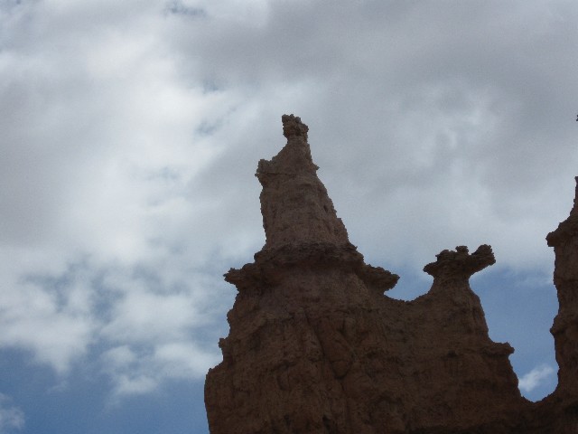
Locust-like, the sinuous stream of German tourists, the crowd sprinkled with a few other nationalities, winds down the switchbacks toward Wall Street. It's an amazing throng. It looks like the line of insurance company executives stampeding for many millions in bonuses while health care is rationed and denied for their benefit. Nothing will ever be right in health care as long as it is a corporate profit game. From where did they all come, these Germans and others? The CG (camp ground) is hardly 1/2 full, perhaps less.
Dave, Tiffany, Rob P., and I are hiking through Wall Street on our way to the Queen's Garden Loop. Stunning pinks and sparkling whites punctuate the pinnacles. A pause at the Dr. Seuss-like Bristlecone Pines is also featured.
The walking is a good respite from riding, a good butt-rest Bryce.
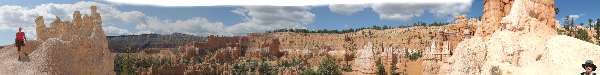
|
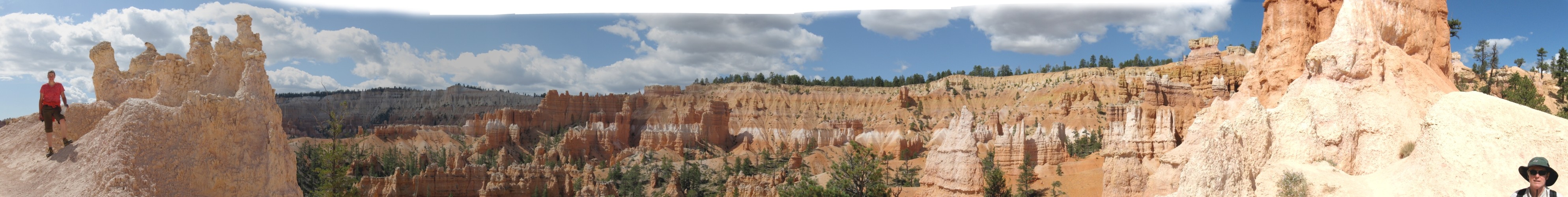
|---|
Bryce - Tiffany to Dave Pano
(Image is very wide - scroll to view it (3975 x 500; 524kb) - Click
the image for the full-size image)
|
|---|
|
|
|---|
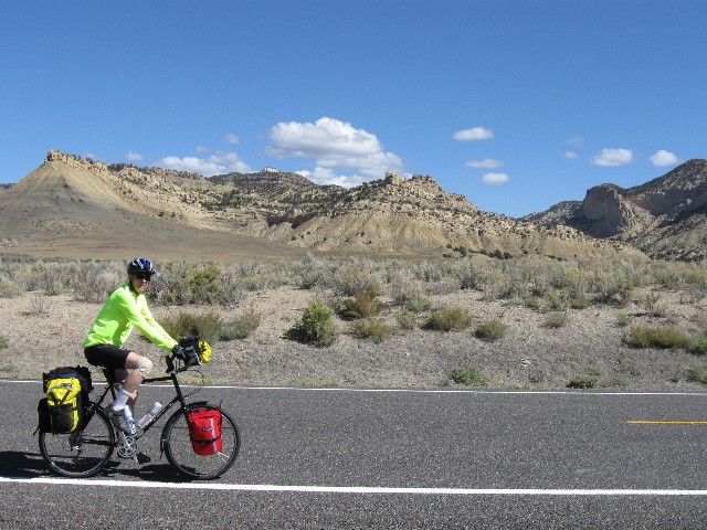
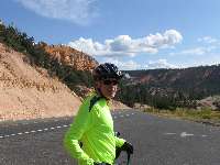
Day 5 Dave rides big down hill
(Click the image for a full-size view)
|
|---|
|
|---|
Dave and color country
(Click the image)
|
|---|
|
|
|---|
Dave and color country
(Click the image for a full-size view)
|
|---|
|
|
|---|
Cheryl - too pooped to pump
(Click the image)
|
|---|
|
|
|---|
Cheryl heads for Kodachrome SP
(Click the image for a full-size view)
|
|---|
|

|
|---|
Rob heads for Kodachrome SP
(Click the image for a full-size view)
|
|---|
|

|
|---|
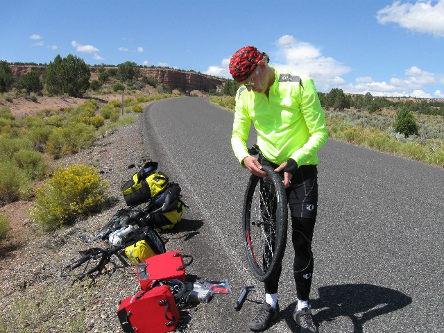
First flat of the tour
(Click the image)
|
|---|
|
|
|---|
Tiffany - what happened to your tire?
(Click the image for a full-size view)
|
|---|
|
|
|---|
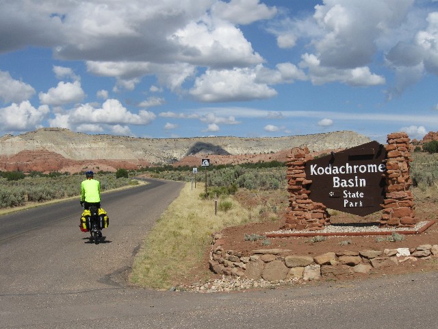
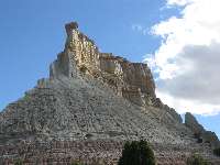
Kodachrome!
(Click the image for a full-size view)
|
|---|
|
|
|---|
Kodachrome SP
(Click the image)
|
|---|
|
|
|---|
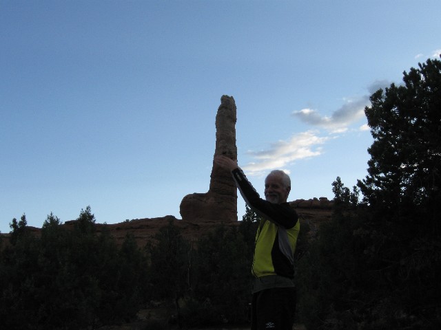
Brigham's Unit
(Click the image for a full-size view)
|
|---|
|
|
|---|
Why Kodachrome?
(Click the image for a full-size view)
|
|---|
|
|
|---|
Zig and - what?
(Click the image)
|
|---|
|
|
|---|
Why Kodachrome?
(Click the image for a full-size view)
|
|---|
|
|
|---|
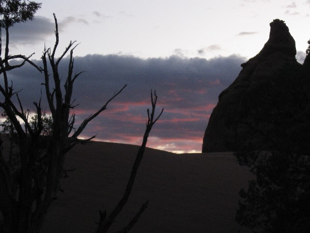
Sweet sunset, Kodachrome
(Click the image for a full-size view)
|
|---|
|
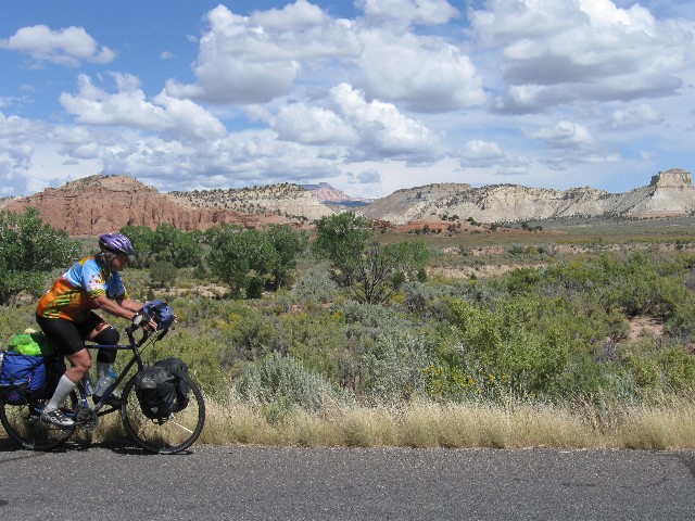
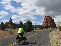
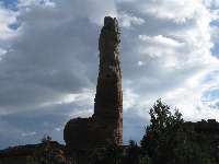
Day 5: Kodachrome Lilt: : Bryce to Kodachrome SP; 23.7 miles; up 600'; down 2200'; camp at 5900'. (156.2 total miles.)
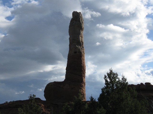
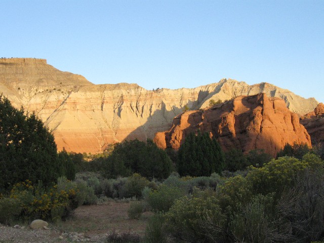
The gnarled and wrinkled surface of Brigham's Organ, The Cock Rock, The Porphoritic Phallus, The Dick Stone, the renowned sandstone pipe glows briefly as the sun dips below the very near horizon. Fluted shadows march across the Salmon-pink Entrada SS (Sand Stone) in this state park named after the old film master, Kodachrome State Park. It's a too-soon ending to a deluxe touring day.
Today started with the scenic plunge off the plateau, lilting and undulating through eons of rock strata. Dave and I stop in Tropic and enjoy an early lunch. This, after dawdling around camp drying tent flies and warming like lizards in the sun. It rained just at bed time last night.
After Tropic, Cyclist Rule #1 is enforced - Headwind. Yet, it's a brief jaunt to Canyonville, where we turn South and roll toward the SP, repairing a thorn puncture along the way (Dave's tire). Ahh, warm temperatures and extra pleasant vistas!
It's pleasant and calm and warmish as the muscles rehydrate and rest and the crepuscular time collapses.
An evening stroll along the billows of Entrada SS, gazing at the 6000 years (or less) of geologic history - per the zealots who dictate "religious freedom" to all (as long as it's their rightly republican style of "religion") - is grand indeed. A magnificent generator-free evening ensues.

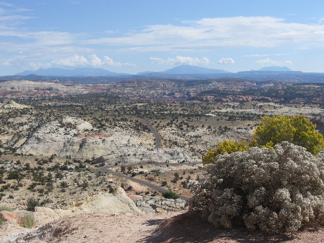
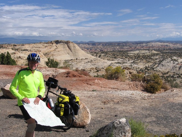
|
|---|
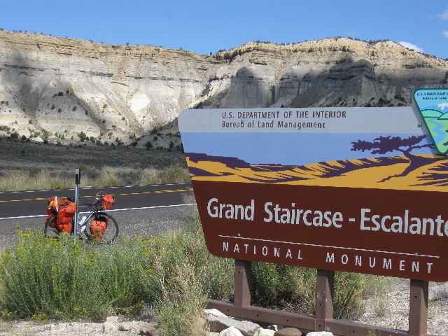
Day 6 - Rob P packs light
(Click the image for a full-size view)
|
|---|

|
|---|
Bye to Kodachrome
(Click the image)
|
|---|
|
|
|---|
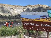
Hello Grand Staircase-Escalante NM
(Click the image for a full-size view)
|
|---|
|
|
|---|
Grand Staircase-Escalante NM
(Click the image)
|
|---|
|
|
|---|
Grand Staircase-Escalante NM
(Click the image for a full-size view)
|
|---|
|
|
|---|
Pass to Escalante
(Click the image for a full-size view)
|
|---|
|
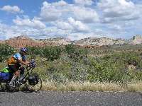
Day 6: Escalante Dreaming: : 43.1 miles; up 2350'; down 2460'; camp at 5950'. (199.3 miles total.)
Lugging nearly to a stop, I inch up the worming high-angle road from the Paria into the Escalante drainage. After a pleasant roll from Kodachrome SP to Cannonville, where I get apples and plums from the trees near the city building, and followed by a pause at the store for a few snacks, we turn onto Hwy 12 and into the wind. Wind from the East - where is the prevalence of the prevailing wind from the SW? Following the 1st Law, it's in your face. We are headed for Escalante Petrified Wood SP, just short of the burg of Escalante, where every resident is required to own and operate (daily) a road grader, destroying your public lands. Yes, this is the place where the sheriff pulled out most of the "no ATVs" signs in the Grand Staircase-Escalante NM. Yes, this is the area which tries to deny the public its public lands, selfishly wanting to lock it up for their private commercial abuse.
Despite the head wind, it's a delightful day, lined by glorious cliffs of pinks and a native buff.
Into the Escalante drainage, it's a pleasing low angle glide to the park, albeit today it requires peddling most of the way.
Sunset and most clouds to the N, S, and West depart. Not so those to the East. A walk of the small park produces petrified log chunks. There are nice warm showers, yet this SP is not as scenic as Kodachrome, my choice for a layover day.
A rousting kettle of Vultures numbering well over 20 wheels into the crepuscular, apparently sniffing some fine dead meat. Could it be one of those dreadful county commissioners?

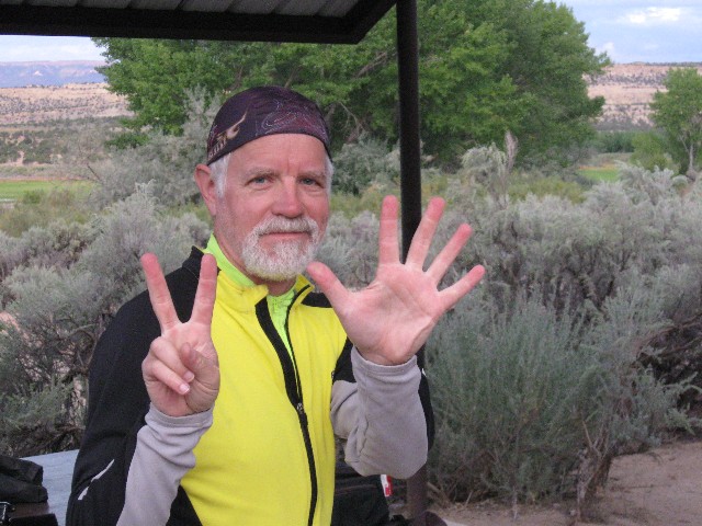
|
|---|
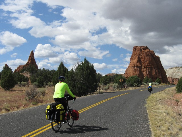
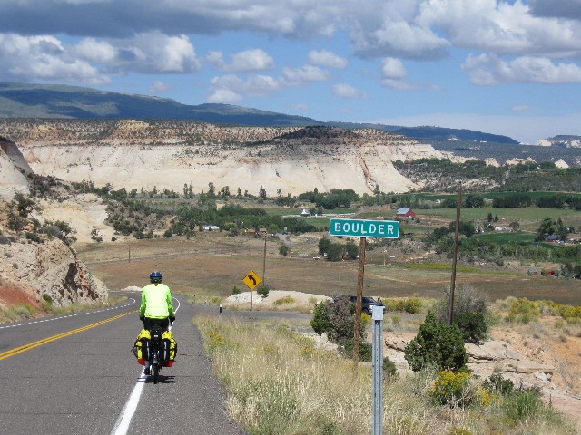
Day 7- Zig signals Day 7
(Click the image for a full-size view)
|
|---|
|
|---|
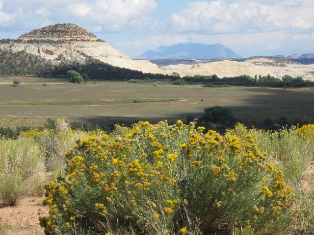
Boulder View
(Click the image)
|
|---|
|

|
|---|
Boulder View
(Click the image for a full-size view)
|
|---|
|
|
|---|
Boulder View
(Click the image)
|
|---|
|
|
|---|
Boulder View
(Click the image for a full-size view)
|
|---|
|
|
|---|
Carnage
(Click the image for a full-size view)
|
|---|
|
|
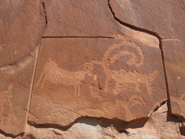
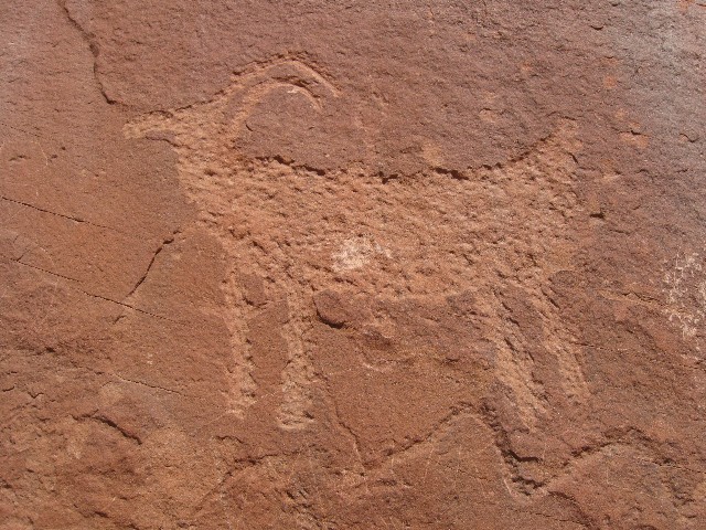
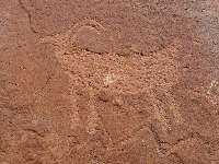
|---|
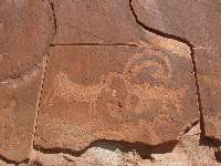
Petro
(Click the image)
|
|---|
|
|
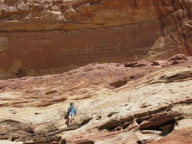
|---|
100 Hands Panel
(Click the image for a full-size view)
|
|---|
|
|
|---|
Rob P grings to Hogback
(Click the image for a full-size view)
|
|---|
|
|
|---|
Dave grings to Hogback
(Click the image)
|
|---|
|
|
|---|
Rob P grings to Hogback
(Click the image for a full-size view)
|
|---|
|
|
|---|
View into Calf Creek
(Click the image for a full-size view)
|
|---|
|
|
|---|
Boulder Town view
(Click the image)
|
|---|
|
|
|---|
Boulder Town view
(Click the image for a full-size view)
|
|---|
|
|
|---|
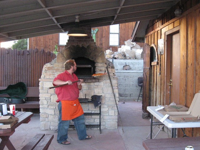
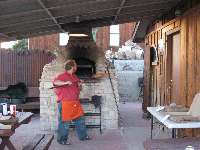
Wood fired
(Click the image for a full-size view)
|
|---|
|
Day 7: The Short 100-mile Ride: : Escalante SP to Boulder town (John V.'s house); 29.7 miles; up 2214'; down 1883'. Camp at 6480'. (229 total miles.)
Eating wood-fire cooked pizza and listening to a local Boulder trio improvise about Everett Ruess, found, and drinking Apricot Hefeweizen is such a contrast to riding the hogback across the thin neck separating Boulder Creek from Calf Creek. A thin band of Navajo SS cradles the ribbon of tarmac carefully placed by the CCC (Civilian Conservation Corp). Not a place for free-ranging winnehogos, yet fine for 1000-mile per gallon bicycle touring machines.
Light fades from the white Navajo escarpment behind the scenic toilets of Hills and Hollows Store and gas stop at the W end of Boulder.
We started out from the SP and made it to Escalante before stopping for pancakes, a distance of 2 or so miles. Then on and up and then down into the crossing of the Escalante near where Calf Creek pours in. A hike up the native SS brings us to vandalized petros and the 100-hands picto panel. The road leads up, 14% grade in pitches and steep all the way beyond the Hogback. Then, finally down into Boulder town. Cheryl says it's a short ride that rides like a hundred miles.
|
|---|
Day 8 - Zig begins long grind
(Click the image for a full-size view)
|
|---|
|
|---|
Rob at Boulder Mtn shoulder summit
(Click the image)
|
|---|
|
|
|---|
Rob P rides to summit
(Click the image for a full-size view)
|
|---|
|
|
|---|
Boulder View of desert vistas - Henry Mtns. in distance
(Click the image)
|
|---|
|
|
|---|
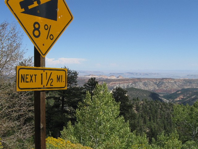
Finally, a bit of down hill, and it's only 8%
(Click the image for a full-size view)
|
|---|
|
|
|---|
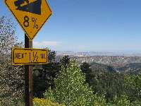
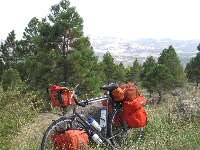
Trusty Specialized Expedition (circa 1984) rides again
(Click the image for a full-size view)
|
|---|
|
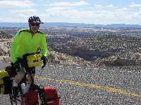
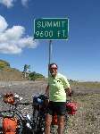
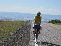
Day 8: Over the Shoulder, Huge Boulder: : Boulder town to Torrey, completing the circle tour. 39.4 miles; up 3500'; down 3580', to the TH at 6875'. (268.4 total miles.)
Grinding slowly, I'm once again thinking about re-gearing the VM (Venerable Monster, the Specialized Expedition long-distance touring bicycle) on this 15-mile ascent to the 9600' summit - actually the shoulder of Boulder Mountain, between MP (mile post) 100 and 101. An ebony cloud is growling and spitting above Boulder Mountain. Elsewhere, the sky is a robin egg blue. Up and up more. Thirty five hundred feet of climbing with nary a respite. When the down comes, it is transient, then the road heads up again. It rolls down, settling out a few miles outside of Torrey. To the East are gorgeous vistas toward the Henry Mountains, rising from the sea of redrock. The Wingate of the land of Capitol Reef prominently appears, and Rob P. and I ease to where we part for the route home.
And, so ends the Circle Tour of Central Utah, a pretty great place.
GPS tracks and maps
|
|
|---|
Map - UT: Bike Tour; 2009; 268 miles
(Click the image to see the map)
|
|---|
|
Links
Click here or on the happy cyclists to go to all WV reports about Bicycle Touring
|
|---|
Looking for All Wilderness Vagabond trip reports about Bicycle Touring?
Click the image to go to All WV reports about Bicycle Touring
|
|---|
|
| | | | | | | |